


Your Journey, Our Expertise...
Menu

Chulu Far East Peak Climbing – 21 Days
21 Days •
Chulu Far East Peak Climbing – 21 Days

Overview

Duration: 21 Days
Maximum elevation: approx. 6,059 m / 19,880 ft
Difficulty: Advanced / technical high-altitude peak
Best seasons: Spring and autumn are generally preferred for climbing conditions.
Starting point: Kathmandu
Ending point: Kathmandu
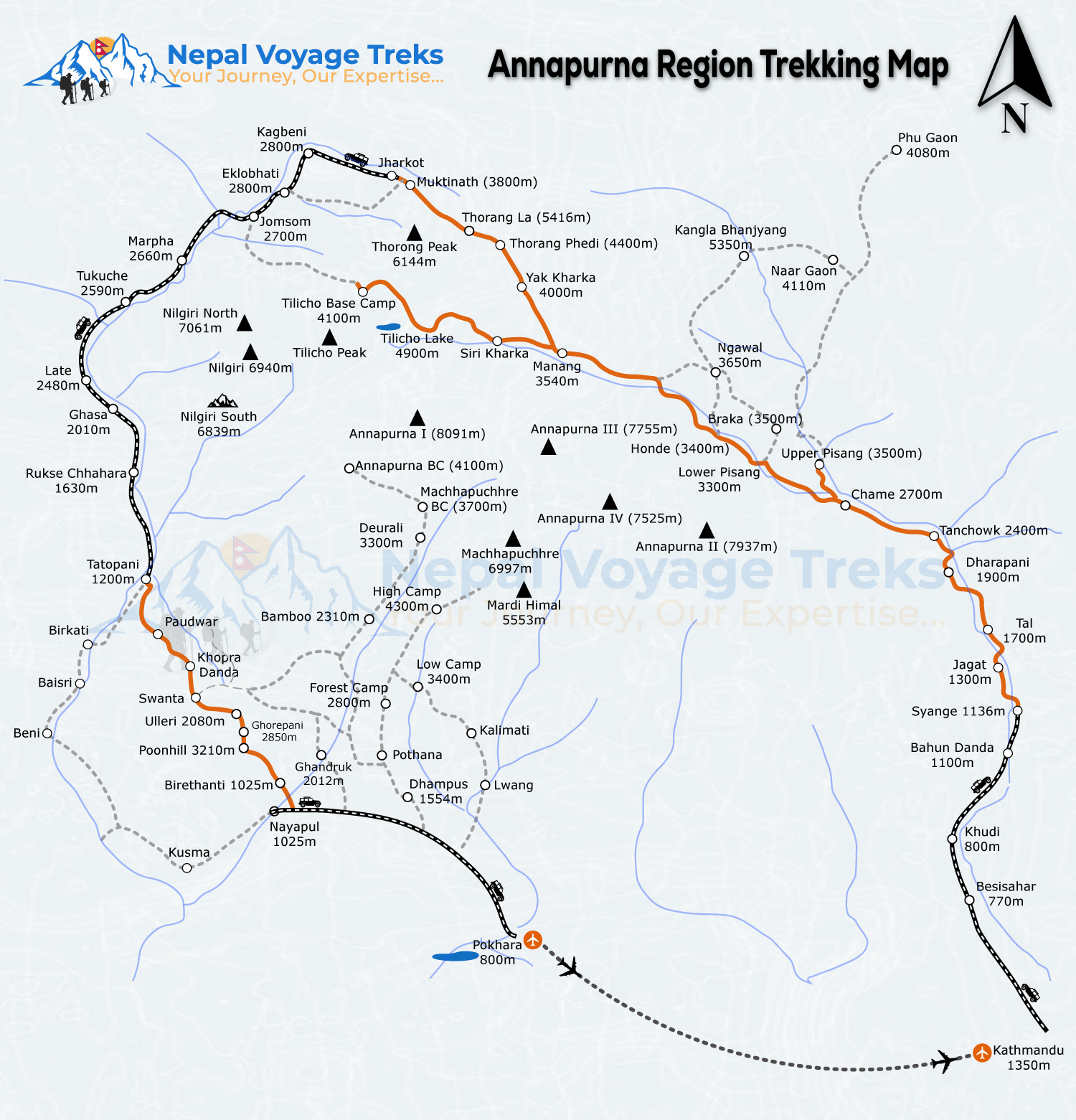
Main trekking region: Annapurna – Manang – Chulu Far East – Thorong La – Mustang

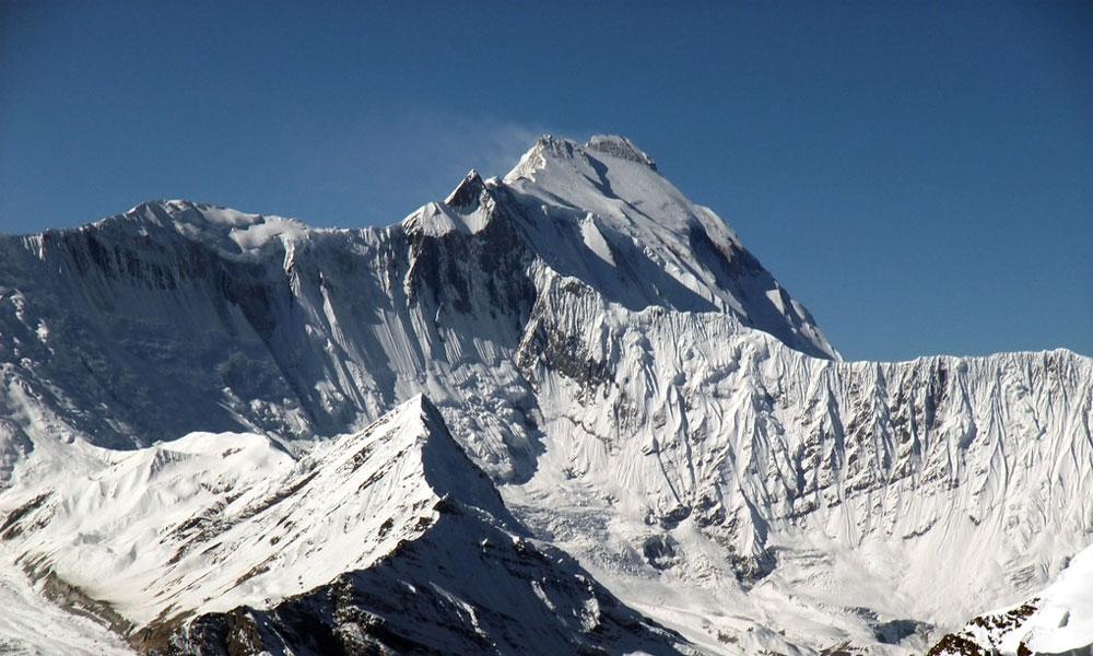
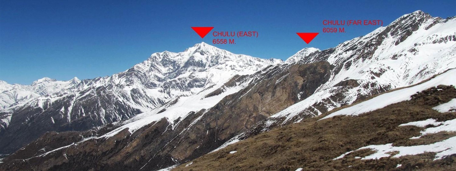
The Chulu Far East climbing itinerary combines the spectacular Annapurna Circuit landscape with a genuine Himalayan peak-climbing experience. The route passes through subtropical valleys, pine and rhododendron forests, traditional Gurung villages, the high alpine landscape of Manang, glacial terrain and finally the summit environment around 6,000 metres. A number of published itineraries use a similar progression with acclimatization around Ngawal/Manang, Chulu Far East Base Camp and High Camp before the summit attempt

Chulu Far East Peak Climbing – 21 Days

Trekking & Hiking Adventure

Region Annapurna Region
Day 1 — International Arrival in Kathmandu – 1,400 m
Ups ↑ +00 m
Down ↓ -00 m
Elevation 1400 m
Distance ⟺ 8km

Upon your arrival at Tribhuvan International Airport, a representative from Nepal Voyage Treks will meet you at the airport and welcome you in traditional Nepali style. You will be transferred by private vehicle to your Kathmandu hotel,  at 3 star hotel . and welcome dinner with nepali traditional restaurent dal bhat , where you can rest after your international journey. In the evening, there will be a short briefing about the Chulu Far East Peak expedition, including the trekking route, accommodation, meals, climbing equipment, permits, safety procedures and guide/porter arrangements. If time permits, you can enjoy a traditional Nepali welcome dinner with cultural music and dance.

Elevation: Kathmandu – approx. 1,400 m
Transportation: Private vehicle
Walking: Minimal
Accommodation: Hotel

Accomodation: hotel
Meals: B/L/D
Duration: 30m
Day 2 — Full-Day Kathmandu Heritage Sightseeing & Climbing Preparation
Ups ↑ +00 m
Down ↓ -00 m
Elevation 1400 m
Distance ⟺ 35km


Today is a combined Kathmandu Valley cultural sightseeing and climbing preparation day. Kathmandu Valley contains seven UNESCO World Heritage monument zones representing the historic cities and religious traditions of the valley.

Your sightseeing can include the six major heritage sites requested for your package:

1. Kathmandu Durbar Square

The historic royal palace area of Kathmandu, with traditional courtyards, temples, palaces and Newari architecture.

2. Swayambhunath Stupa

Also known as the Monkey Temple, Swayambhunath is one of the valley's important Buddhist religious sites and sits on a hill overlooking Kathmandu.

3. Pashupatinath Temple

One of Nepal's most important Hindu pilgrimage sites, situated beside the sacred Bagmati River. Non-Hindu visitors can view the temple complex and religious activities from permitted areas.

4. Boudhanath Stupa

One of the great Buddhist pilgrimage sites of Kathmandu, with a huge white dome, prayer wheels, monasteries and Tibetan Buddhist cultural influence. Kathmandu Metropolitan City describes Boudhanath as the largest stupa among the stupas of Kathmandu Valley.

5. Patan Durbar Square

Located in the ancient city of Lalitpur, Patan is famous for its Newari craftsmanship, temples, courtyards, stone and metal artwork and traditional architecture.

6. Bhaktapur Durbar Square

Bhaktapur preserves a particularly impressive medieval Newari urban environment, with temples, palace courtyards, traditional brick buildings and artistic wood and metal craftsmanship.

UNESCO officially identifies Kathmandu, Patan and Bhaktapur Durbar Squares together with Swayambhu, Boudhanath, Pashupati and Changu Narayan as the seven monument zones of Kathmandu Valley.

In the late afternoon, you return to the hotel for final climbing preparation and equipment checking. Your climbing guide checks boots, crampons, harness, helmet, ice axe, ropes and other technical equipment.

Elevation: 1,400 m
Sightseeing: Full day
Walking: Approximately 3–5 km depending on sightseeing route
Accommodation: Hotel
Meals: Breakfast

Accomodation: hotel
Meals: B/L/D
Duration: 8h
Day 3 — Kathmandu – Besisahar – Dharapani
Ups ↑ +500 m
Down ↓ 150 m
Elevation 1960 m
Distance ⟺ 300km

After an early breakfast, we drive from Kathmandu toward Besisahar, the gateway to the Annapurna region, and continue toward Dharapani depending on road and local conditions. The journey follows river valleys and winding Himalayan roads, with views of green hills, waterfalls, terraced farmland and rural settlements.

Elevation: Dharapani approx. 1,860–1,960 m
Driving: approximately 8–10 hours depending on road conditions
Trail: Motor road
Accommodation: Lodge

The landscape gradually changes from the lower green hills toward the mountain environment of Manang.

Accomodation: lodge
Meals: B/L/D
Duration: 8-10h
Day 4 — Dharapani – Chame
Ups ↑ +800 m
Down ↓ -100 m
Elevation 2670 m
Distance ⟺ 16km

Today the actual trekking begins. The trail follows the Marshyangdi Valley through forests and traditional mountain villages. You pass through areas of pine, fir and rhododendron forest and gradually enter the spectacular mountain scenery of the Manang region.

The trail includes both gradual ascents and short descents, with beautiful views of surrounding peaks.

Elevation: Chame – approx. 2,670 m
Walking: 5–6 hours
Distance: approximately 15–16 km
Ascent: approximately 800 m
Descent: relatively minor
Terrain: Forest trail, stone sections and local road
Vegetation: Pine, fir, rhododendron and Himalayan shrubs
Mountain views: Lamjung Himal, Annapurna II and surrounding peaks

Accomodation: lodge
Meals: B/L/D
Duration: 5-6h
Day 5 — Chame – Upper Pisang
Ups ↑ +600 m
Down ↓ -100 m
Elevation 3200 m
Distance ⟺ 16km

The trail continues through beautiful forests and narrow mountain valleys toward Pisang. You cross streams and walk beneath impressive cliffs and snow-covered Himalayan peaks. As the altitude increases, the vegetation becomes thinner and the landscape becomes increasingly alpine.

Elevation: Upper Pisang – approx. 3,200 m
Walking: 5–6 hours
Distance: approximately 14–16 km
Ascent: approximately 500–600 m
Descent: short sections
Trail: Forest, stone trail and mountain path

The area offers spectacular views of Annapurna II, Annapurna IV and Pisang Peak.

Accomodation: lodge
Meals: B/L/D
Duration: 5-6h
Day 6 — Upper Pisang – Ngawal
Ups ↑ +700 m
Down ↓ -100 m
Elevation 3660 m
Distance ⟺ 12km

Today is one of the most scenic days of the trek. We take the higher route toward Ghyaru and Ngawal, which provides magnificent panoramic views of the Annapurna range.

The trail climbs steadily through dry mountain terrain. As we gain altitude, the landscape changes from forest to alpine grassland and rocky slopes.

Elevation: Ngawal – approx. 3,660 m
Walking: 4–6 hours
Distance: approximately 10–12 km
Ascent: approximately 500–700 m
Descent: some short sections
Trail: Steep stone steps and mountain paths
Mountain views: Annapurna II, III, IV, Gangapurna and surrounding peaks

Accomodation: lodge
Meals: B/L/D
Duration: 6h
Day 7 — Acclimatization Day at Ngawal
Ups ↑ +400 m
Down ↓ -200 m
Elevation 3664 m
Distance ⟺ 6-7 km

Today is an important acclimatization day before moving toward the high-altitude Chulu region. Rather than simply staying inside the lodge, we recommend a short acclimatization hike around the village and surrounding ridges.

You can explore the traditional village, Buddhist monasteries, chortens, prayer walls and local agricultural areas while enjoying views of the Annapurna mountains.

Elevation: Ngawal – approx. 3,660 m
Walking: 3–5 hours optional acclimatization hike
Ascent/descent: approximately 200–400 m depending on hike
Purpose: Acclimatization and preparation

This rest-and-acclimatization approach is commonly incorporated into Chulu Far East climbing itineraries before entering higher elevations.

Accomodation: lodge
Meals: B/L/D
Duration: 3-5h
Day 8 — Ngawal – Chulu Far East Base Camp
Ups ↑ +900 m
Down ↓ -00 m
Elevation 5300 m
Distance ⟺ 8 -10 km

Today we leave the main villages and enter the more remote high-altitude environment toward Chulu Far East Base Camp. The trail becomes increasingly rugged, with barren slopes, alpine vegetation, rocky terrain and glacial landscapes.

Elevation: Base Camp approximately 4,600–5,000 m depending on the selected climbing route and camp location 5300
Walking: approximately 5–7 hours
Distance: approximately 8–12 km
Ascent: approximately 900–1,300 m
Terrain: Rocky alpine trail, moraine and steep mountain terrain

At this altitude, the landscape is dominated by juniper, alpine grasses, small shrubs and bare rock. Wildlife becomes less common, but Himalayan birds and occasional mountain animals may be seen.

Accomodation: lodge
Meals: B/L/D
Duration: 6-7h
Day 9 — Acclimatization and Climbing Training at Base Camp
Ups ↑ +400 m
Down ↓ -300 m
Elevation 5300 m
Distance ⟺ 6-7 km

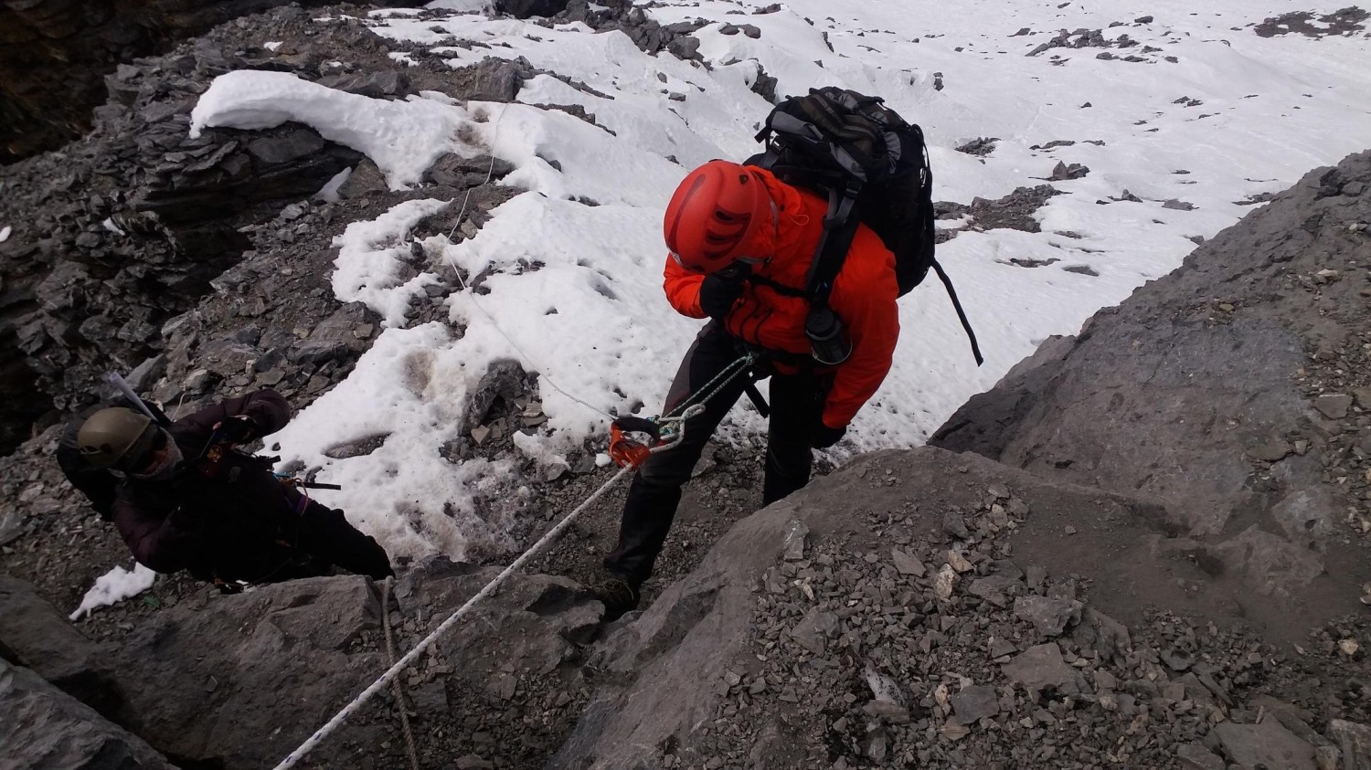
Today is dedicated to acclimatization and climbing preparation. Your climbing guide will conduct practical training with the group, including the correct use of crampons, harness, helmet, ice axe, climbing rope and basic glacier techniques.

Depending on weather and group condition, you may take a short hike above Base Camp before returning for rest.

Elevation: approximately 4,600–5,000 m
Walking: 2–4 hours optional
Purpose: Acclimatization + technical climbing training

This day is particularly important because the summit is above 6,000 m.

Accomodation: camp-lodge
Meals: B/L/D
Duration: 4h
Day 10 — Chulu Far East Base Camp – High Camp
Ups ↑ +700 m
Down ↓ -00 m
Elevation 500 m
Distance ⟺ 6-7 km

Today we climb from Base Camp toward High Camp. The terrain becomes steeper and more exposed, and the trail may include rocky moraine, snow and glacial sections depending on the season and current mountain conditions.

High Camp: approximately 5,300–5,500 m
Walking: 3–5 hours
Ascent: approximately 500–700 m
Descent: minimal
Terrain: Rocky moraine, snow/glacier terrain and steep slopes

After reaching High Camp, the climbing team prepares equipment for the summit attempt. The guide will check the weather forecast, climbing equipment and route conditions.

Accomodation: camp-lodge
Meals: B/L/D
Duration: 5h
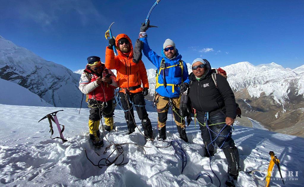
Day 11 — Summit Day – Chulu Far East Peak, approx. 6,059 m
Ups ↑ +800 m
Down ↓ -900 m
Elevation 6059 m
Distance ⟺ 8km


https://images.openai.com/static-rsc-4/5LgbeHKc9Vt_1Meg0FrI5BoUagoxx7vlhhFhH6XB4FAzjkvJVGyQo6a7L-pMZ2Ru6MJsi055WTA_ssKMIMyV4YOySLejn1hcc_FB7uhXqaMGhOfiq_pyTb8pDyj8RSq1sftOUVuieuxa0L3Cj81Xufccg0yYnn3P7V0lawWYaCGcRZt6H3qtg5tjIyu1kTa9?purpose=fullsize


https://images.openai.com/static-rsc-4/wfSADkqXJzBv2ssP2jk2kbhy8bTvepX02d-ZqKd0AgITgHe7qU7cYEAsw7EQz-lGYqys1KiEwsaNcg3uHs4GwVyH1ORUy-cGN-MnWZUBHkjH6pRLf5E1Y03QtYoJkokbsc37PdC9uRdvKf3SHosR_pzBxCGbPEiIlILKiUSGfLVhPk3FXim93h5K0XFNB-Dp?purpose=fullsize


https://images.openai.com/static-rsc-4/3d7cPsaPiGQhOXKhcdNz1tWRXl55ipS2IqUHhc4ndn7TgwlwtGVxD_MgJMDM941B0UdRG28DXIKnr4hQG0Ji_j90_tot-BVVp1qNwvpqAJeeSUXw2oWZYM28dsZf5dlAoAc812xds6f_LSF2iejX0ht6pyvq--Z6p20ShXDdqzaSgAPxXudAhXhuu9bbJjyP?purpose=fullsize

7

This is the major objective of the expedition. We wake very early, usually before dawn, and begin climbing while the snow and mountain conditions are generally more suitable.

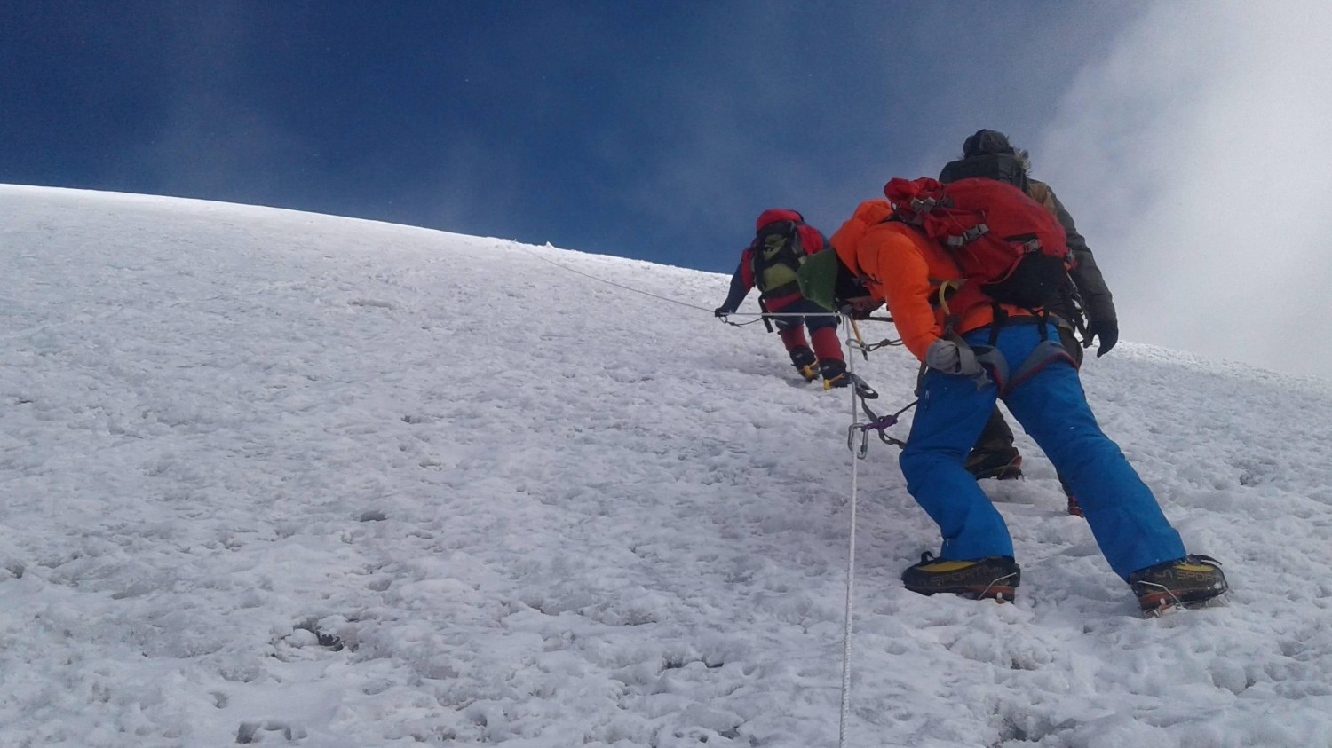
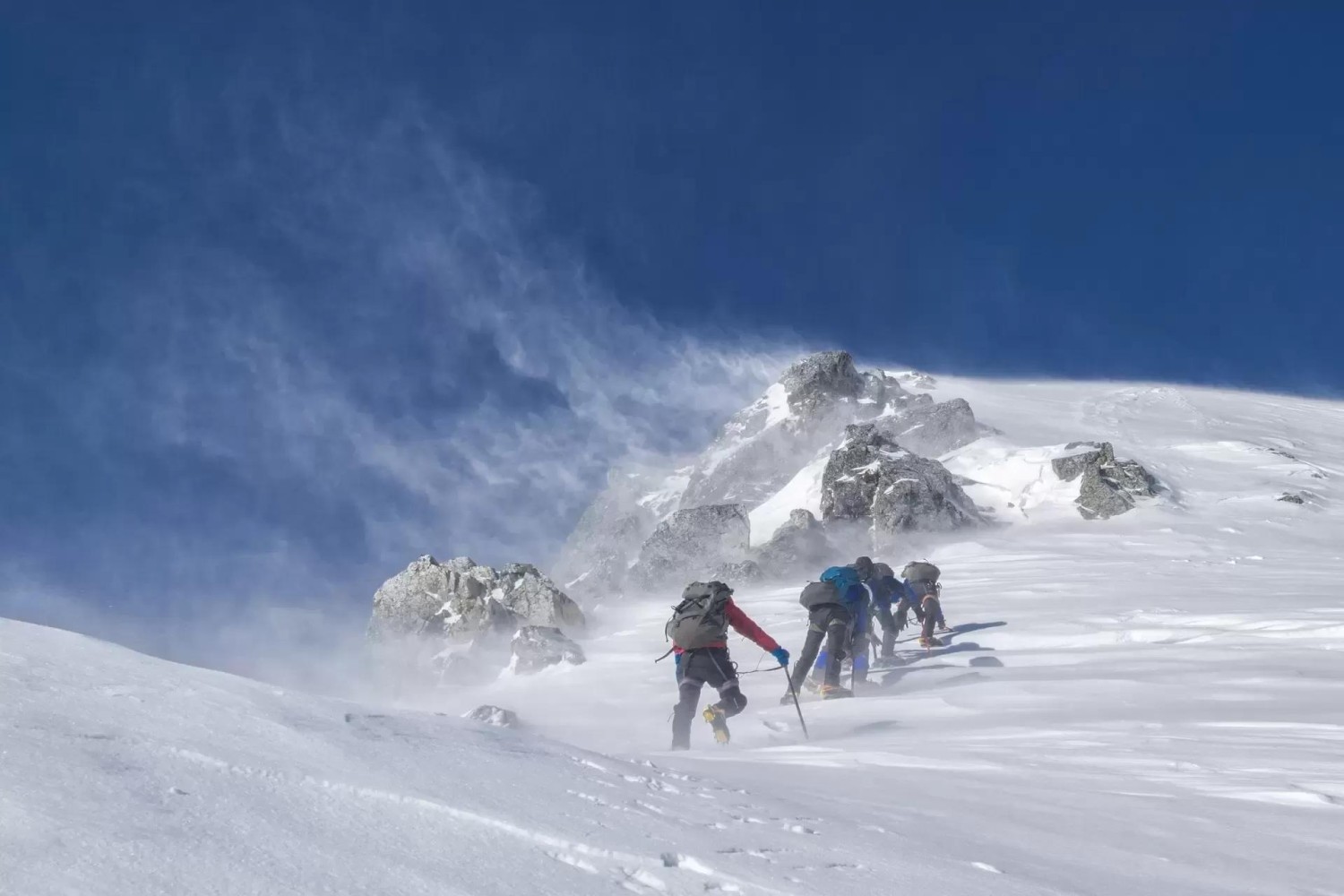
The route may involve snow, ice, glacier travel, steep sections and rope-assisted climbing depending on current conditions. The exact climbing technique and equipment required are determined by the qualified climbing guide according to the mountain conditions.

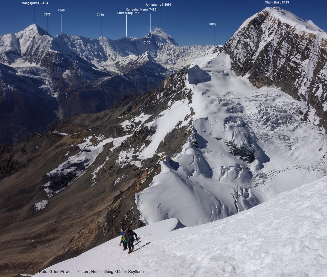
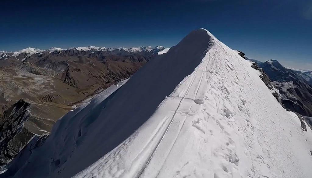
After reaching the summit, you can enjoy extraordinary Himalayan views, potentially including Annapurna II, Annapurna III, Annapurna IV, Gangapurna, Tilicho Peak, Dhaulagiri and other surrounding Himalayan peaks, subject to weather and visibility. Published Chulu Far East itineraries also describe panoramic views toward the Annapurna and surrounding ranges from the summit.

After spending a safe amount of time at the summit, we descend carefully to High Camp/Base Camp.

Summit elevation: approx. 6,059 m
Walking/climbing: approximately 7–10+ hours depending on conditions and route
Ascent: approximately 700–800 m from High Camp
Descent: substantial
Difficulty: Technical/high altitude
Accommodation: Camp

Important: Summit-day duration and exact route are weather- and snow-condition dependent.

Accomodation: camp
Meals: B/L/D
Duration: 8-9h
Day 12 — Reserve / Contingency Day

This is a very important safety day. Mountain weather can change rapidly, and a summit attempt may sometimes need to be postponed because of strong winds, snowfall, poor visibility or unsafe snow/ice conditions.

If the summit was successfully completed on Day 11, this day can be used as additional rest or for descending toward a lower elevation. If the summit attempt was unsuccessful because of weather or route conditions, this day provides another opportunity, subject to the climbing leader's assessment.

Accomodation: camp
Meals: B/L/D
Day 13 — Chulu Base Camp – Manang
Ups ↑ +200 m
Down ↓ -150 m
Elevation 3500 m
Distance ⟺ 16km

We descend from the high-altitude climbing area toward the main Annapurna Circuit and continue to Manang. After several days in the high mountains, the descent to a lower elevation is physically and psychologically refreshing.

Elevation: Manang – approx. 3,500 m
Walking: 5–7 hours
Distance: approximately 12–16 km
Descent: significant
Terrain: Rocky trail, alpine slopes and village paths

Manang is one of the most important settlements in the region, with traditional stone houses, monasteries, mani walls and dramatic mountain scenery.

We descend from the high-altitude climbing area toward the main Annapurna Circuit and continue to Manang. After several days in the high mountains, the descent to a lower elevation is physically and psychologically refreshing.

Elevation: Manang – approx. 3,500 m
Walking: 5–7 hours
Distance: approximately 12–16 km
Descent: significant
Terrain: Rocky trail, alpine slopes and village paths

Manang is one of the most important settlements in the region, with traditional stone houses, monasteries, mani walls and dramatic mountain scenery.

Accomodation: lodge
Meals: B/L/D
Duration: 7h
Day 14 — Manang to Ledar (via Yak Kharka)
Ups ↑ +700 m
Elevation 3540 m
Distance ⟺ 12km


The trek transitions from the wide Manang valley into the high-alpine tundra wilderness. Leaving Manang village (3,540m), the trail gently ascends through the Jarsang Khola valley. The route passes through the small agricultural settlement of Gunsang (3,950m) before reaching the wide, alpine meadows of Yak Kharka (4,050m), where mountain horses and yaks graze. After a brief lunch rest at Yak Kharka, the trail continues along the riverbank, crosses a wooden suspension bridge over the Jarsang Khola river, and makes a final short, steady climb onto the high ridge to reach the small cluster of tea houses at Ledar (4,250m). The trail situation is completely free of vehicle roads, consisting of established, dusty, and rocky single-track mountain paths. The thin air makes even gradual climbs physically demanding, requiring a very slow, deliberate pace to prevent altitude sickness. [1, 2, 3]

Segment Metrics & Logistics

  • Total Distance: 11.4 kilometers (7.1 miles).
  • Trekking Time: 4 to 5 hours of steady walking.
  • Elevation Change: Starts at 3,540 meters and finishes at 4,250 meters.
  • Total Vertical Ascent: 707 meters (2,320 feet) of total accumulated climbing.
  • Total Vertical Descent: Approximately 60 meters of minor undulating downhill dips. [1, 2, 3]

Flora, Fauna, and Visible Mountains

  • Flora and Fauna: Vegetation thins out into sparse alpine scrub, dwarf juniper, and high-altitude mosses. Massive domestic herds of yaks dominate the pastures. Trekkers frequently spot wild Himalayan Blue Sheep (Bharal) grazing on the steep, rocky slopes, alongside soaring golden eagles, vultures, and large Himalayan griffons. [1, 2]
  • Visible Mountains: The entire segment acts as a scenic gallery providing close-up views of Annapurna II, Annapurna III, Annapurna IV, the towering Gangapurna Glacier with its turquoise lake, Tilicho Peak, and the sharp white ridges of the Chulu Massif. [1, 2]

Would you like me to update the full 19-day master itinerary on your site nepalvoyagetrekking.com to officially separate Yak Kharka and Ledar into two individual trekking days for better client acclimatization?


Accomodation: lodge
Meals: B/L/D
Duration: 5h
Day 15 — Yak Kharka lather– Thorong Phedi
Ups ↑ +500 m
Down ↓ -100 m
Elevation 4500 m
Distance ⟺ 8 -9 km

Today we continue toward Thorong Phedi. The landscape becomes barren and dramatic, surrounded by enormous rocky and snow-covered mountains.

Elevation: Thorong Phedi – approx. 4,400–4,540 m
Walking: 3–5 hours
Distance: approximately 7–9 km
Ascent: approximately 400–500 m
Terrain: Rocky alpine trail, narrow sections and moraine

We take an early dinner and prepare our clothing, headlamp, water and other equipment for tomorrow's Thorong La crossing.

Accomodation: lodge
Meals: B/L/D
Duration: 5h
Day 16 — Thorong Phedi – Thorong La Pass – Muktinath
Ups ↑ +1000 m
Elevation 5416 m
Distance ⟺ 18km


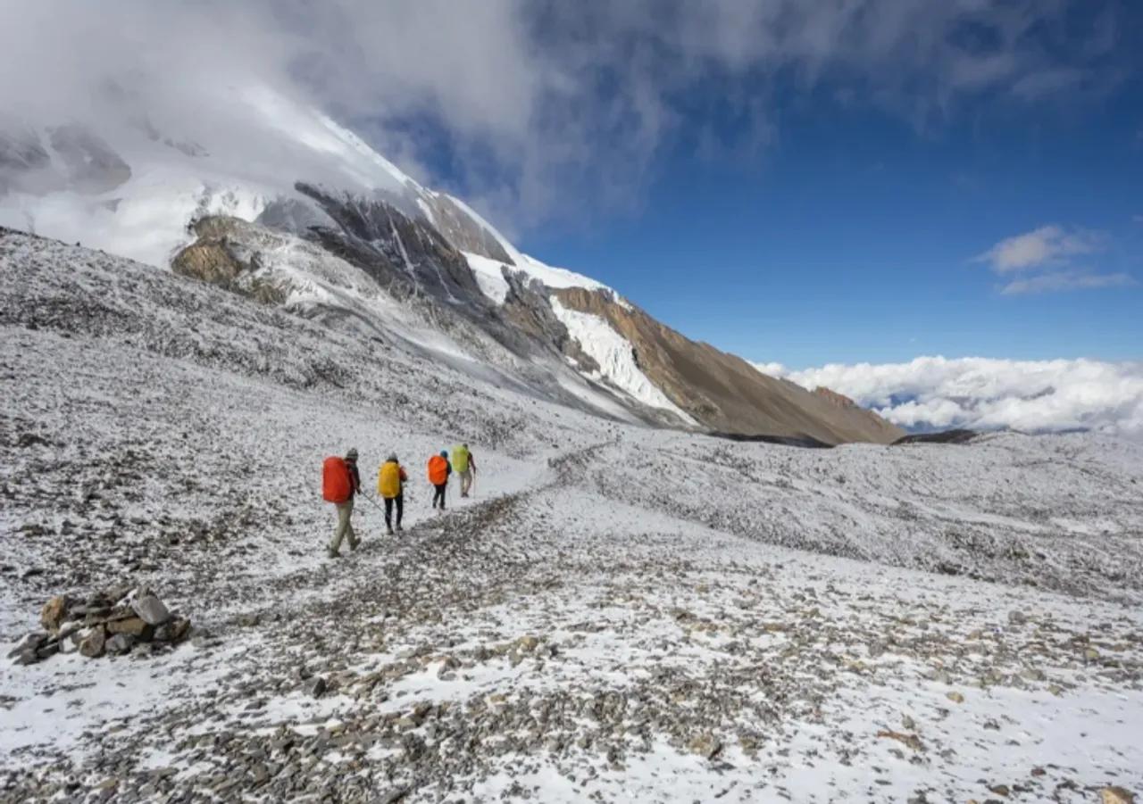
Today is another major high-altitude day. We start very early and climb toward Thorong La Pass at approximately 5,416 m.

The ascent is steep but follows a well-established mountain route. After reaching the pass, we celebrate the crossing and enjoy spectacular views before beginning the long descent toward Muktinath.

Thorong La: 5,416 m
Muktinath: approx. 3,800 m
Walking: 7–9 hours
Distance: approximately 14–16 km
Ascent: approximately 1,000 m
Descent: approximately 1,600 m
Terrain: Rocky, steep and high-altitude

Published Chulu Far East itineraries commonly include Thorong La after the peak, followed by descent to Muktinath.

Accomodation: lodge
Meals: B/L/D
Duration: 7-9h
Day 17 — Muktinath – Jomsom
Ups ↑ +200 m
Down ↓ -100 m
Elevation 2700 m
Distance ⟺ 18km

After breakfast, we continue through the dramatic Mustang landscape toward Jomsom, passing through traditional settlements and the Kali Gandaki Valley.

Depending on the final route and road conditions, this section can be walked or partly supported by local transportation.

Elevation: Jomsom – approx. 2,700 m
Walking: 4–6 hours if trekking
Distance: approximately 14–18 km
Descent: significant
Terrain: Dry Himalayan valley, rocky trail and road

The landscape is much drier than the Manang side, with strong Himalayan winds commonly developing later in the day.

Accomodation: lodge
Meals: B/L/D
Duration: 6h
Day 18 — Jomsom – Pokhara
Ups ↑ +00 m
Down ↓ -00 m
Elevation 800 m
Distance ⟺ 200km

Today we take the scenic flight from Jomsom to Pokhara, subject to weather and flight availability. The flight provides spectacular views of the Kali Gandaki valley and surrounding mountains.

Jomsom: approx. 2,700 m
Pokhara: approx. 800 m
Flight: approximately 20–25 minutes, weather dependent

After arriving in Pokhara, you have time to relax beside Phewa Lake or explore the lakeside area.

Accommodation: Hotel
Meals: Breakfast

Accomodation: hotel
Meals: B/L/D
Duration: plain 30 minuts or drive to pokhara
Day 19 — Pokhara – Kathmandu
Ups ↑ +600 m
Down ↓ -160 m
Elevation 1400 m
Distance ⟺ 200km

After breakfast, we travel back to Kathmandu by tourist vehicle or flight according to the package selected and current transportation conditions.

Kathmandu elevation: approx. 1,400 m
Driving: approximately 6–8 hours by road
Flight: approximately 25–30 minutes if flying

After arrival in Kathmandu, you can relax, shop for souvenirs or enjoy your final evening in Nepal.


Accomodation: hotel
Meals: B/L/D
Duration: 9h drive
Day 20 — Kathmandu – Free / Buffer Day
Ups ↑ +00 m
Down ↓ -00 m
Elevation 1400 m
Distance ⟺ 00

This day is kept as a buffer day, which is especially useful for an international climbing expedition. It provides protection against possible weather delays, transportation delays, flight cancellations or additional recovery requirements.

dinner party of the seccessfull of the chulu far east peak  delicious 

If everything has gone according to schedule, clients can enjoy free time in Kathmandu, shopping, walking around Thamel or relaxing at the hotel.

Elevation: approx. 1,400 m
Activity: Free day / contingency
Accommodation: Hotel

Accomodation: hotel
Meals: B/L/D
Duration: day
Day 21 — Final Departure from Kathmandu
Ups ↑ +00 m
Down ↓ -00 m
Elevation 1400 m
Distance ⟺ 8km

After breakfast, your Nepal Voyage Treks representative will transfer you from the hotel to Tribhuvan International Airport according to your international flight schedule.

We will assist you with your departure arrangements and say farewell with the hope that your Chulu Far East Peak expedition has created unforgettable memories of Nepal.

Airport transfer: Private vehicle car, van, haish ,buss , jeep , depend  of the clints pax
Trip ending: Kathmandu, Nepal

Meals: breakfast
Duration: 30m

ASSOCIATED WITH

Tourism Board
Nepal Government
Keep
NMA Nepal
TAAN

WE ACCEPT