Your Journey, Our Expertise...
Menu

Lumba Sumba Pass Trek (Kanchenjunga to Makalu) from arrivle to till depature 21 Days Kathmandu to Kathmandu Trek

21 Days •

Overview

Lumba Sumba Pass Trek (Kanchenjunga to Makalu)

20 Days Kathmandu to Kathmandu Trek

Nepal Voyage Trekking


https://images.openai.com/static-rsc-4/WCs_cA777sBgPU9cPaJ6bCTFvOMBbVgVtOc5oQhrdf1AdOIl4uk_sQFUCWnhU9DowYv506pHf0QYdNoQtKNkTWoB2ZNEzwC13Q9tjbYyXJ1XDeJWkdX-0LJx6kuSVZG34AWVIz-Hk_u_wLQ44Aw_fnz8bHu71dLZtbRRCRFgwfQSfaDriWdIvUTAeBk3F0c0?purpose=fullsize


https://images.openai.com/static-rsc-4/Cf2HPkf_z0tgjZXS1ephx57cbrKlJv8N1TpWE2XXAkv4MNF5riFIuOJ5cgogNSSG_j3AkEHDn1piPcYa00HfKQA0l1qWdeIVI0lZ_K_Y_LrTnlEFVeQZkw6ILS4ETlCjm9MP-iPNwlryPGUORv86gvLbwTyqO_3bGuKaZX2G3eSItiWUHnJyjS5W8-ejwVRf?purpose=fullsize


https://images.openai.com/static-rsc-4/Rbfjo4Tfy_-CevJxEMOSzVlAXAy0MPvmqncOim49xL1dxgigV6T3fCK48fRimCHFsuV3JpGT8fXezpSyxQMlTKWxYv5pIluwNVI98T-3rgKziuw1RsJRK2e4V0AtNkZCLll9a9gn5ivlHXKfzw4L7niOPpzotJs2kgjkyBFoJKIT3NsJDTa24F4byHR5T7pu?purpose=fullsize

4

Lumba Sumba Pass Trek – The Ultimate Wilderness Journey Between Kanchenjunga and Makalu

The Lumba Sumba Pass Trek is one of Nepal's most extraordinary wilderness adventures, linking two of the world's greatest mountain regions—Kanchenjunga (8,586 m), the world's third-highest peak, and Makalu (8,485 m), the fifth-highest. Hidden in the remote eastern Himalayas, this spectacular trekking route offers an unforgettable journey through pristine forests, glacier-fed rivers, traditional mountain villages, and the dramatic high-altitude crossing of Lumba Sumba Pass (5,177 m).

Unlike the popular Everest and Annapurna trails, Lumba Sumba remains one of Nepal's least-traveled trekking routes, making it ideal for experienced trekkers seeking solitude, authentic Himalayan culture, and untouched natural beauty. The trail follows ancient trade paths once used by local communities and Tibetan traders, passing through traditional Limbu, Rai, Sherpa, and Tibetan villages where centuries-old customs, monasteries, and warm hospitality remain part of daily life.

From lush subtropical valleys filled with cardamom fields and bamboo forests to alpine meadows, yak pastures, and snow-covered mountain passes, every day reveals a new landscape. Along the journey, trekkers may encounter colorful rhododendron forests, orchids, medicinal herbs, and wildlife such as the elusive Red Panda, Himalayan Tahr, Musk Deer, Himalayan Monal, Blood Pheasant, and, with exceptional luck, even signs of the Snow Leopard.

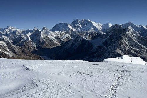
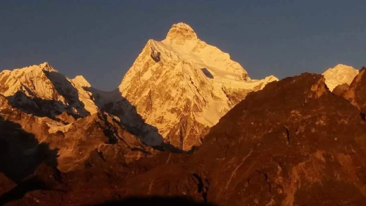
Crossing the magnificent Lumba Sumba Pass is the highlight of the expedition. From the summit, breathtaking panoramas unfold across the eastern Himalayas, including Kanchenjunga, Makalu, Jannu (Kumbhakarna), Chamlang, Baruntse, Peak 6, Peak 7, and countless snow-covered ridges stretching toward Tibet. This challenging yet rewarding crossing connects the Kanchenjunga Conservation Area with the Makalu Barun National Park, creating one of Nepal's finest long-distance trekking experiences.

For trekkers looking for adventure beyond the crowded trails, the Lumba Sumba Pass Trek offers a perfect blend of spectacular mountain scenery, rich biodiversity, diverse cultures, and genuine wilderness exploration.


Trek Facts

Item Details
Trek Duration 20 Days
Starting Point Kathmandu
Ending Point Kathmandu
Highest Elevation Lumba Sumba Pass (5,177 m)
Total Trekking Distance Approximately 210–225 km
Difficulty Challenging
Accommodation Hotels in Kathmandu and Tea Houses/Lodges during the trek
Best Seasons March–May & September–November
Trek Style Tea House Trek

Trek Highlights

  • Trek between Kanchenjunga and Makalu, two of the world's highest mountains.
  • Cross the spectacular Lumba Sumba Pass (5,177 m).
  • Explore the remote Kanchenjunga Conservation Area and Makalu Barun National Park.
  • Experience authentic Limbu, Rai, Sherpa, and Tibetan cultures.
  • Visit the beautiful Tibetan village of Olangchung Gola.
  • Walk through rhododendron forests, bamboo groves, alpine meadows, and glacial valleys.
  • Enjoy excellent opportunities to observe Himalayan wildlife.
  • Trek on one of Nepal's most peaceful and least-crowded Himalayan routes.

Package Price (Suggested)

Group Size Price (USD per Person)
2 Trekkers $2,650
4–6 Trekkers $2,350
7–10 Trekkers $2,150

Price Includes

  • Airport transfers
  • Three nights' hotel accommodation in Kathmandu (with breakfast)
  • Domestic flights and private ground transportation
  • All required trekking permits
  • Licensed English-speaking trekking guide
  • Porter service (1 porter for every 2 trekkers)
  • Tea house accommodation during the trek
  • Breakfast, lunch, and dinner during the trek
  • Government taxes and company service charges


Lumba Sumba Pass Trek (Kanchenjunga to Makalu) from arrivle to till depature 21 Days Kathmandu to Kathmandu Trek

Trekking & Hiking Adventure

Region Kanchenjunga and Makalu Region
Day 1 — Arrival in Kathmandu (1,350 m)
Ups ↑ -00 m
Down ↓ -00 m
Elevation 1350 m
Distance ⟺ Driving Time: 30–45 minutes

Arrival in Kathmandu (1,350 m)


https://images.openai.com/static-rsc-4/sx9BdHHaCZd2TlxHoA0JAuNewtfGSO-tslCAbDm3P9PjupHfO5FaUKRWLSBvBTx2ovF6lbSGjoxMx2PcCLDB5w4iGU62gz94oD0K6Q8Ejg5sHbERVFxG8sXnR34d8XSAjpjWdnGlLw_baeusUiudmIHO2qyZl7XLWwlH_cqDPiDW_fx5igQxOve5rDAxdrGZ?purpose=fullsize


https://images.openai.com/static-rsc-4/FdwPp4sm9gEYi9IYDQoxeGxXVaTJxGmJrEsYXagOpx_g_OxTMXMXgG_F234nvuIpPX38EhopJ5DjcF1R0gLBx-FilBKlrNPzzE_m5LPxAg2e-sptKl699Ov8YOXWxK6gtbR5SSeTRgzCtyf8Qjtcd3uaN-4ZbY46brIb4iS7JB6oe_7fueYWaf18yF0nFGYA?purpose=fullsize


https://images.openai.com/static-rsc-4/bClEyOHuTxy-RANaRR8WxPEbb4J6qj-6zfbzPrBa29136dXGRScBhqKIna3S6tPIIre6PtsqCt2Vd-7xek68XImlOv49C9Q7S-vzQWguDd4pOFEHDllcHLvjk3-jXvjpu-yYCp6_T2fKMwwRycl97_-sHHF0tOIa3iIEEkQqPgm79ATe7fyTwJLcfzdlWyu_?purpose=fullsize

Driving Time: 30–45 minutes
Accommodation: Hotel (Kathmandu)
Meals: Welcome Dinner

Your adventure begins with your arrival at Tribhuvan International Airport in Kathmandu, where our friendly team from Nepal Voyage Trekking greets you with a traditional Nepali welcome. A comfortable transfer takes you to your hotel, allowing time to relax after your international journey.

In the evening, enjoy a welcome dinner featuring authentic Nepali cuisine while meeting your trekking guide. During the briefing, your guide explains the journey ahead, route conditions, altitude awareness, equipment, and safety procedures. As you look toward the distant Himalayan skyline, excitement builds for the remarkable expedition that awaits.

Accomodation: hotel
Meals: B/L/D
Duration: Driving Time: 30–45 minutes
Day 2 — trekking prearation day
Ups ↑ -00 m
Down ↓ -00 m
Elevation 1350 m
Distance ⟺ 6-7 km

The Lumba Sumba Pass Trek is an epic, highly remote traverse that connects two of the world’s most magnificent mountain regions: Kanchenjunga (the 3rd highest peak) and Makalu (the 5th highest). As a key section of the Great Himalaya Trail, it takes you through untouched wilderness, dense bamboo forests, and high-altitude alpine zones.

Because it crosses the challenging Lumba Sumba Pass (5,159m / 16,925 ft) and enters areas with virtually no tourist infrastructure, prepping for this trek requires careful planning.

1. Physical & Mental Preparation

This is a strenuous to demanding trek. You will be walking 6 to 8 hours a day, often on faint, overgrown, or rocky trails, carrying a pack at high altitudes.

  • Cardio Endurance: Start training at least 3–4 months in advance. Focus on long-distance running, cycling, or rowing to build lung capacity.

  • Strength & Stair Training: Do weighted hikes, squats, and lunges. Training on stair climbers or steep hills is crucial for the relentless ups and downs.

  • Mental Grit: You will be cut off from modern comforts, internet, and hot showers for weeks. Mental resilience is just as important as physical fitness.

2. Logistics, Permits, & Guiding

You cannot do this trek entirely solo. Because it passes through restricted border areas near Tibet, Nepal law requires a registered guide and a minimum of two trekkers.

  • Required Permits:

    • Kanchenjunga Conservation Area Project (KCAP) permit.

    • Makalu Barun National Park entry permit.

    • Restricted Area Permits (RAP) for Olangchung Gola and Bhotkhola.

  • Trek Style: While some villages have basic homestays, the high-altitude section over the pass requires a fully supported camping setup with tents, a kitchen crew, and porters.

3. Gear & Clothing Strategy

You will experience everything from subtropical heat in the low valleys to freezing, sub-zero winds on the pass. Layering is your best friend.

  • Sleep Gear: A high-quality down sleeping bag rated for at least -15°C to -20°C.

  • Footwear: Sturdy, broken-in trekking boots with excellent ankle support. The trail past the village of Thudam is notorious for being overgrown with bamboo and hard to navigate—good grip is mandatory.

  • Layers: Thermal base layers, a thick down jacket, a windproof/waterproof outer shell, and lightweight hiking pants.

  • Power: You will be away from electricity for days. Bring a heavy-duty, cold-resistant power bank or a portable solar charger.

4. Health, Acclimatization, & Safety

Altitude sickness (AMS) is a real risk when crossing a 5,000+ meter pass.

  • Pace Yourself: Ensure your itinerary includes at least one or two dedicated acclimatization days (usually in villages like Ghunsa or Olangchung Gola) before pushing toward the pass.

  • Medication: Pack Diamox (for altitude), water purification tablets (crucial, as you’ll rely on stream water), and a robust first-aid kit containing broad-spectrum antibiotics and blister care.

  • Evacuation Insurance: Ensure your travel insurance specifically covers emergency helicopter evacuation up to 6,000 meters. If something goes wrong out here, a helicopter is the only way out.

5. Best Season to Go

  • Autumn (October – November): Offers the clearest skies and most stable weather, making it the absolute best window to catch jaw-dropping views of Kanchenjunga and Makalu from the top of the pass.

  • Spring (March – May): Beautiful for the blooming rhododendron forests, though there may be lingering winter snow blocking the high pass early in the season.


Accomodation: hotel
Meals: B/L/D
Duration: Driving Time: 30–45 minutes
Day 3 — Kathmandu – Bhadrapur Flight – Taplejung Drive (1,820 m)
Ups ↑ -0 m
Down ↓ 000 m
Elevation 1820 m
Distance ⟺ 240 km

Kathmandu – Bhadrapur Flight – Taplejung Drive (1,820 m)


https://images.openai.com/static-rsc-4/OaakWepnMpfL2oRLQeSiZzrC7ZxPk7Uc5n5b2fs8I8kxCeKrrYJkol-FFP4-GYJlRXaYIuOat50LigIpVOCpp-23hjkPVwSb5Mf_FVqRIj2kwz4DaeHM6Eif4_PSQ4eEI0M-gYpQ7WGusOGKmLUqlc3NShTAUwjC5__etbtZtg169YB6oMe_JaFB5qOQSNuy?purpose=fullsize


https://images.openai.com/static-rsc-4/gXHf8lrZEPaGlVrSqbPMqVty8NhfxTd6CsEhwHKllv0_DXMh4fcI--WTxR1gWNzuNRsWqn6TxcwzHXLI35sMwAAhVzILyPCpcThSB8gGaXWnihfRpOYVuQpI6KokbSlrVjUR2l-wgoECNTJ1aUAFE9FRt5MK-RksS9MZLfWFCc48k7uzyNVpaKIkZ785CtRv?purpose=fullsize


https://images.openai.com/static-rsc-4/2u7A2ET3_KFdIEd6m0mS1Ewp44dUFysHZjPaDxZZps5W64iOXMwmqpebR0ypf5uy-5YJm9MuenfPgyKHF48Q50fa3eiMzwINU2R5hq8DhR2yBYYcgNdxifMFN9_LOHgQ6Cbzqqf04iiUptO4teNtQXDqDwNbxZC1RX3yebGfUPfo0EPrbpnB_tbmTUmBYxzn?purpose=fullsize

6

Flight: Kathmandu to Bhadrapur (45 minutes)
Drive: Bhadrapur to Taplejung (8–10 hours)
Distance: Approximately 240 km by road
Accommodation: Lodge
Meals: Breakfast, Lunch, Dinner

After breakfast, we take a scenic morning flight from Kathmandu to Bhadrapur, located in the eastern part of Nepal. The flight provides beautiful views of the Himalayan range on clear days. From Bhadrapur, we begin a long but exciting drive through eastern Nepal.

The road passes through green tea gardens, traditional villages, winding mountain roads, and beautiful river valleys. Slowly the landscape changes from the warm lowlands into the cooler Himalayan foothills as we approach Taplejung, the gateway to the Kanchenjunga region.

Visible mountains (weather permitting):

  • Kanchenjunga range
  • Eastern Himalayan peaks

Flora:

  • Tea plantations
  • Cardamom farms
  • Sal forests

Fauna:

  • Himalayan birds
  • Monkeys
  • Local wildlife
Accomodation: lodge
Meals: B/L/D
Duration: Approximately 240 km by road
Day 4 — Taplejung – Mitlung (921 m)
Ups ↑ +250 m m
Down ↓ -00 m
Elevation 921 m
Distance ⟺ 12 km

Taplejung – Mitlung (921 m)


https://images.openai.com/static-rsc-4/ULmZ7lshIQ3Q9Coa845S7zltqDHa_E0kvYGiTt-X074luVy-M_x0wUhPz9QQ7RnaA5Y9XZcw_ZYmH6SZmVbJyP6-r9fq0zhT1cttahfgW79rlKy9G_wFzR2A8FGHRzgCz2ZsBclwTW6UWE4HAOAYOBQfjLXXNc2sY9Juzzp242un_Sk7PBYx_7xtKfwpGPTR?purpose=fullsize


https://images.openai.com/static-rsc-4/p3UTd8BslLvlmxu_b68zH-FGFO_J9vMehs-TKcEwb4yFS4_yWqJABZMdg-WwX4-0nyLsxzfvpahs1sd92CaKV65zaw8WPkxPcnNOYvl7iedT4iyM39qYH_TxOQQn-mk_akpZpz77Gp8YjbfgBddV4tkKqrRoz6Sf9uBBvDLvkFFxFM-qdb1j4n_TH2dFrAX1?purpose=fullsize


https://images.openai.com/static-rsc-4/GxUfa1hlF6sGSFzFM6vFf-p6r-c8VwALh86-7GDnM-ovJKIZ2qvkbd-3j3pjlI1yKpDYvV2ah8eY9vcj2Qp0tlH9DXpwO6GwIarndl_N93hgo5G7vCnPJilhNWEVf7J0TNgm8hDYwgc6RvsfGizgslKCuUDOIe8dmH830owam8h5kw9Bv16Y0NXGGcdjb5rh?purpose=fullsize

7

Starting Elevation: 1,820 m
Ending Elevation: 921 m
Distance: 12 km
Walking Hours: 5–6 hours
Ascent: +250 m
Descent: -1,150 m
Accommodation: Tea house/Lodge
Meals: Breakfast, Lunch, Dinner

Today we officially begin our trekking adventure toward the hidden valleys of Kanchenjunga. The trail descends from Taplejung through beautiful countryside, terraced farmland, and traditional Limbu villages before reaching the peaceful riverside settlement of Mitlung.

The path follows the beautiful Tamor River, one of eastern Nepal’s important Himalayan rivers. The sound of flowing water, green forests, and friendly local villagers create the first unforgettable experience of the trek.

Trail Condition:

  • Stone paths
  • Forest trails
  • Village pathways

Visible Mountains:

  • Kanchenjunga foothills
  • Jannu (Kumbhakarna) region

Flora:

  • Cardamom plantations
  • Bamboo
  • Pine
  • Oak forests

Fauna:

  • Himalayan birds
  • Langur monkeys
  • Small mammals
Accomodation: Lodge
Meals: B/L/D
Duration: 5–6 hours
Day 5 — Mitlung – Chiruwa (1,270 m)
Ups ↑ +600 m m
Down ↓ -00 m
Elevation 1270 m
Distance ⟺ 15–16 km

Mitlung – Chiruwa (1,270 m)

https://images.openai.com/static-rsc-4/0zvm6Cs-UoTlRi2K4YbPSlTfjVlOV0u8kT5EBG146ULsnjSc6R3cXhbDc0xGPMm2LvvX2_BfqjHRIUQ8vxyBKUYK5OBUfIiDjQi_l4VPAvOV8tyNCEfqbpFsIGQRcBOWay1CIqpxe0SK5lDoI3i5ZXWYwj55PDwJ8wTVIdwKFq5y2RbSsK9V-Wd1JdkOOOJz?purpose=fullsize

https://images.openai.com/static-rsc-4/9kqjGQprkXpHRt5r1tZzk3ktTMHeiJbbKLt8i96n8veI-8lRPzQ9uv6sbole53WU6O5AC1e9JRrhJH-aptnKHmNkeqKac0Ovb453iLF_2ZifNCimn9TruPOM97GfQAS41jQT_q7suBUvOsoOkUkGJoQEomndWq3EKUBK-eFlrPPxWXfz4XrGcHBWpbNmbqDz?purpose=fullsize

https://images.openai.com/static-rsc-4/l8MklscaSKjWCpdkpdoYVFehW6jceTQI3zy0dYzBnt1AN1P6xaerB7G-2DSSVl3x9TJyGzBatSW0aV2aLR2mrsZJcBwG-eteH4Z-IwHiClOQmZbUCyDJlDWMNqUE72v1G7MbArCnLtONUWH5aErLcQnjPlUCqeMsZ3mQJmfmO7i7l0iDyIltFeRSbDljghNp?purpose=fullsize

5

Starting Elevation: 921 m
Ending Elevation: 1,270 m
Distance: 15–16 km
Walking Hours: 6–7 hours
Ascent: +600 m
Descent: -250 m
Accommodation: Tea house/Lodge
Meals: Breakfast, Lunch, Dinner

After breakfast, we continue following the Tamor River through beautiful forest landscapes and remote mountain villages. The trail crosses several suspension bridges and gradually enters the protected area of the Kanchenjunga Conservation Area.

Today’s walk introduces trekkers to the peaceful lifestyle of eastern Nepal. Along the way, you will see farmers working in terraced fields, children walking to village schools, and traditional houses surrounded by green hills.

The changing landscape provides the first feeling that you are entering a true Himalayan wilderness.

Visible Mountains:

  • Jannu (Kumbhakarna) area
  • Kanchenjunga eastern peaks (distant views)

Flora:

  • Bamboo forest
  • Rhododendron
  • Alder trees
  • Ferns

Fauna:

  • Himalayan Monal
  • Eagles
  • Wild birds

(Continue next: Day 6–10: Chiruwa to Olangchung Gola and Lumba Sumba Base Camp with full details.)


Accomodation: Lodge
Meals: B/L/D
Duration: 6–7 hours
Day 6 — Chiruwa (1,270 m) – Lelep (1,687 m)
Ups ↑ +600 m m
Down ↓ -00 m
Elevation 1686 m
Distance ⟺ Approximately 14 km

Chiruwa (1,270 m) – Lelep (1,687 m)


https://images.openai.com/static-rsc-4/kjlWmm6jMCOmoOCCaGpjdFtxDJ_q-dvUYXajLzJkeB5X5GZ9AXXB9IgjVddSc8FoEk7QISSmwZNxhaTahZmOfyXMSKrENbxEEnXN7wDynRm9cQrKUB1_kh74EG1gA7Q9rjZDiP05h5FyD_1PDPP11Hu5WstTi3c8qzir5Wgviklf93WlY7U89YObkIbh4wux?purpose=fullsize


https://images.openai.com/static-rsc-4/oEFT3BqJSHMrdfV1XDm1gPkAJIr-JMO3OKKt8Ka58vZYjLArFmu0K_Wo09iau4TzdHGIroag5vpowWC1WixhUuQTcqAD_8gbENC4Pb9HkK86RdfXLopl5JMY_bOkXDC0Wx9-xk0Bff5Rhlrbi8gdGUPMySwFYRjU9UNwzGKczqYDkDeQITSwjyr6KoKM9Jga?purpose=fullsize


https://images.openai.com/static-rsc-4/vIsXtEffuIK6KDZd84521LJEEf-In8O4FLqCNUH53174zVg0LpfDJqoehR_qI_Y-ELvBjzft1Q3677PRzwGfUR0MPG8cfxQYQoLNDTOT1G90z6m496x_6G8nDoCXGOXwDgwUt57ouxfg62RDqWw7AxEBsISXRKwYGuw2UOs8XijKbud0n44pHR44pNaCTCaR?purpose=fullsize

5

Starting Elevation: 1,270 m
Ending Elevation: 1,687 m
Distance: Approximately 14 km
Walking Hours: 6–7 hours
Ascent: +600 m
Descent: -180 m
Accommodation: Tea house/Lodge
Meals: Breakfast, Lunch, Dinner

After breakfast in Chiruwa, we continue deeper into the remote Kanchenjunga region following the beautiful Tamor River. The trail gradually climbs through dense forests, crossing small streams and traditional mountain settlements. As we move higher, the environment becomes quieter and more untouched, giving us the feeling of entering a true Himalayan wilderness.

Today’s trail takes us toward Lelep, a beautiful mountain village located near the entrance of the Kanchenjunga Conservation Area. The village is surrounded by green hills, forests, and spectacular Himalayan landscapes. The local people, mainly Limbu and Sherpa communities, warmly welcome visitors and share their traditional mountain lifestyle.

Trail Condition:

  • Forest paths
  • Rocky sections
  • Suspension bridges
  • Gradual uphill walking

Visible Mountains:

  • Jannu (Kumbhakarna) region
  • Kanchenjunga foothills

Flora:

  • Bamboo forests
  • Rhododendron
  • Oak
  • Himalayan medicinal plants

Fauna:

  • Himalayan Monal
  • Wild birds
  • Langur monkeys
  • Small Himalayan mammals


Accomodation: Lodge
Meals: B/L/D
Duration: 6–7 hours
Day 7 — Lelep – Ela Danda (3,200 m)
Ups ↑ 1,550 m m
Down ↓ -50 m
Elevation 3200 m
Distance ⟺ Approximately 12 km

Lelep – Ela Danda (3,200 m)


https://images.openai.com/static-rsc-4/00RFoEMbqWUEb8EeEEO_yc-hZhVCWYzHLCD4rxsqmMHuLdUHPi06lZEQEODYwSvMLVUKC9fIQMDK67g_lCQRZR_umGXlTlT6pWfxlkdjThHGzZhgG8YSHIW6P9BnD_2kF2XpqyXR82bPNmZ4FeffM6IF65m1XGTIcuiBI0IKWwRerlTX3ByNgmdxu0gm5yeq?purpose=fullsize


https://images.openai.com/static-rsc-4/qImNaqgyELnwGJc5cbP7i0aKPXRHu4l1mr2DBxNNp4tt-nC9tNg_ppZZgalrS5MHgWIKUKvmZdh_HqfZvQEFHuFhe9XlNvc5UHIM96wLnRS4UAEAS1lm2x43sgCSomAKwjU_gY6UTTLpwfIoHWqqqmHlQSPRdrnbUf0r151EijGG-hiftvsIVUQ_7lKbyrjw?purpose=fullsize


https://images.openai.com/static-rsc-4/TkvqpGLpMSJGtg154wD3VDMeiLkiGMzs448cDFHSCDh7ynTaqfHzpkU2IoI1Y8dTDjnC7pJkS58mMjtL5Q8ixxnQMEvilQdnX8YJhz8KQDO4e05RLJPPVgkYx3p76NEtrcMToG51sqc0rH8h2wOhnx1UWqxVxbrMCu4Q2MHwLR0cxNqVZd2ZGDMwDaL0g5q6?purpose=fullsize

8

Starting Elevation: 1,687 m
Ending Elevation: 3,200 m
Distance: Approximately 12 km
Walking Hours: 6–7 hours
Ascent: +1,550 m
Descent: -50 m
Accommodation: Tea house/Camp
Meals: Breakfast, Lunch, Dinner

Today is one of the more challenging but rewarding trekking days as the trail climbs steadily from the lower valleys into the high mountain environment. Leaving Lelep behind, we enter beautiful forests filled with rhododendron, bamboo, and alpine vegetation.

The trail becomes steeper as we gain altitude, but every step rewards us with peaceful landscapes, waterfalls, and panoramic views of the surrounding mountains. The remote campsite of Ela Danda provides a beautiful overnight location surrounded by Himalayan nature.

This area is an excellent habitat for rare wildlife, and lucky trekkers may get a chance to see signs of the famous Red Panda.

Visible Mountains:

  • Kanchenjunga range
  • Jannu/Kumbhakarna

Flora:

  • Rhododendron forest
  • Bamboo
  • Juniper
  • Alpine shrubs

Fauna:

  • Red Panda (rare)
  • Himalayan Black Bear
  • Musk Deer
  • Himalayan birds
Accomodation: lodge
Meals: B/L/D
Duration: : 6–7 hours
Day 8 — Ela Danda – Selep Kharka (3,525 m)
Ups ↑ +500 m m
Down ↓ -175 m
Elevation 3525 m
Distance ⟺ Distance: Approximately 11 km

Ela Danda – Selep Kharka (3,525 m)


https://images.openai.com/static-rsc-4/ErCUZAJ5vnGdjPKEyjhFQgpvt5UBliNnG7BDWtd3g-rk8In71S8rdkY5dodX0AcCmzz3k8KFQKSkjbuAd9iITTPOVbX3tIMdo0nHLDqW8oGICBS-3ym_paLquIG2K1ELoobVYAWdzACXfLVf-ZLyrjeLzzL0eZukyfi9UnMc7wutNEVtlBLkwqBSfsfsYZ9p?purpose=fullsize


https://images.openai.com/static-rsc-4/I7cKo_v7vEhK0u2TxyzYFZW27chFOGZGF2hdXzYHlQKzWnp-YmdRUEaDjGGfOGGqZ6-o17b_bp2N_W36fdcnv4kE7zlUpSmYQ8t-t60TTIgwlhMNqkMs3uY-rY8CgJwUBjkqZ5C0gS-aefDI5s6xQtmIHnb8wBkX2V9U4uWo9vvhJte4Cw7Gm1I_Sy3zlHzO?purpose=fullsize


https://images.openai.com/static-rsc-4/-ZZMS-BL7xBA0RKAEZuz3ZgBLwf312uxusRbdcDBgs5e5HpKRB83sAkEzBy0UjqeLjf9p0zKUQzRKrmXvWsjoMgExOWqzoTOsj5wo9whofEgH9n9S0qe7z1vZpAzD9gzlW-y_zGkOOlr7kfVUzORUiVeDQHIrUia4kfQKtugXGMWtsAo6N3NoeOpzZBl7KzV?purpose=fullsize

6

Starting Elevation: 3,200 m
Ending Elevation: 3,525 m
Distance: Approximately 11 km
Walking Hours: 5–6 hours
Ascent: +500 m
Descent: -175 m
Accommodation: Tea house/Camp
Meals: Breakfast, Lunch, Dinner

Today we leave the dense forests behind and enter a more open alpine landscape. The trail climbs gradually through high mountain valleys where colorful wildflowers, grazing areas, and dramatic cliffs surround the route.

Selep Kharka is a beautiful high-altitude pasture area where local people traditionally bring their yaks during summer. The peaceful atmosphere, fresh mountain air, and spectacular scenery make this one of the most memorable camping locations on the trek.

Visible Mountains:

  • Kanchenjunga eastern range
  • High Himalayan ridges

Flora:

  • Alpine grass
  • Juniper
  • Wild Himalayan flowers
  • Medicinal plants

Fauna:

  • Blue Sheep
  • Himalayan Tahr
  • Mountain birds
Accomodation: lodge
Meals: B/L/D
Duration: 5–6 hours
Day 9 — Selep Kharka – Olangchung Gola (3,208 m)
Ups ↑ +300 m m
Down ↓ -250 m
Elevation 3208 m
Distance ⟺ Approximately 12 km

Selep Kharka – Olangchung Gola (3,208 m)


https://images.openai.com/static-rsc-4/3fnXr0Zg-8nEwhM6L6RGSl0gbcxT-Sw2AxrrckRZE9suLsb4LfnCK3DmLR41qPPpkL-zPZJ0GKITDFF22pXlm72HMjkayVTA4-LxyGWhQmV5m84yL0PnDZG0b9k-f9VVn4tlERtpdQk81ESpjUKkp3QN2n_gBph2OQ32R9t4CCNvZXHgurqV_qCVzeTpB7sf?purpose=fullsize


https://images.openai.com/static-rsc-4/8kWo8d083ZC0FWyLbMNwjsAwb5y-nRDTPetj5hkYtR519EYfPOenpaVe0nIg-4OJDNmU3nnkGWkVpwU0vSVWbBaCYTwv1DHtaGPjnlOOH_oRAG4BghWmxOnkoDz6VXnEHQtAtXkU2H79fM7UyAGQodEpT1Je_i0bb1RrbmDk806JMGDEsID0OTPLE8UF5oyL?purpose=fullsize


https://images.openai.com/static-rsc-4/HSOt2bLb-afx_ar-7nYl1aXuGNmKxB7UVtvouXLi7kiWWTzCaZ5MZL6_KE3SV_hZEY-SJPamvfUuGcZ2zdUFdi8tk2liauSHMwnhLPr3tNjw7DwK7XhQztnNu8Uf7coUHfIzblaMkAS-vnYFURrMfvAUfcpOSins3B8RW02QQ8pFf65edPtp7FK8T9Er2AVX?purpose=fullsize

Starting Elevation: 3,525 m
Ending Elevation: 3,208 m
Distance: Approximately 12 km
Walking Hours: 6 hours
Ascent: +300 m
Descent: 6 hoursAccommodation: Lodge/Homestay
Meals: Breakfast, Lunch, Dinner

Today we reach one of the most culturally important villages of the entire trek — Olangchung Gola. The trail descends through beautiful mountain landscapes before arriving at this ancient Tibetan-influenced settlement.

Olangchung Gola is a historic village located along an old trade route between Nepal and Tibet. The village is famous for its traditional stone houses, Buddhist monastery, prayer flags, and unique mountain culture.

Visitors can explore the local monastery and experience the lifestyle of the Sherpa and Tibetan communities who have lived here for generations.

Visible Mountains:

  • Jannu (Kumbhakarna)
  • Kanchenjunga peaks
  • Himalayan valleys

Flora:

  • Juniper
  • Birch
  • Alpine vegetation

Fauna:

  • Himalayan Monal
  • Musk Deer
  • Blue Sheep
Accomodation: Lodge
Meals: B/L/D
Duration: 6 hours
Day 10 — Acclimatization Day at Olangchung Gola (3,208 m)
Ups ↑ +400 m
Down ↓ -400 m
Elevation 3208 m
Distance ⟺ 6-7 km

Acclimatization Day at Olangchung Gola (3,208 m)


https://images.openai.com/static-rsc-4/TIDmzj1cJbJcc-mCq1BsLjZtUSEgeXMnaTT1sdmLChxhDgioyysKORMsIxX5XRz2juWTEwRpfk838zrD9LRIZcDwBqG83eit-ANjKzp5cJ0B2JrOtKro15YhTKdHsmdAcJfWCMq3aEKVBqpPde6Wp17l_uGn2fLGMnflGXRPxP9MejOqQm3Fx7xfJXQOBuUD?purpose=fullsize


https://images.openai.com/static-rsc-4/jmqy566e3mulVJD4op9bLk9NdQSV1u8ScltUTlZ-zqf7wcWzP4K3qv0yTzjfLVfjy9dsrW7HMV824O98NuhFTt2mrXarRMkYKK0LKYSzLVAJYdpTQCgvhsUmjQ_aVuwCj8hoafIZb0oLLgn7fksKW5a-YKtt4bebPsieIeJWZPLEfBCyKVQl6ntkSXcd2fif?purpose=fullsize


https://images.openai.com/static-rsc-4/dgNNeSrrCS0-jvqWUHGBGGYasH8x1XGrf4wIRi3fKPuecvLuZ2XPNTOg-Iy3of2Ar31yHGE-_0ZFE8AgS03A75aIKYHRpvyCj8iEoQXyhLVE3L8-PLagfiz9CeP991x11pOyfbEzuhj4uI9mmLhO3HdnMnXWWd02JQKkzS0XG2UyDbF24Wkca2r58SnXwBk_?purpose=fullsize

Altitude: 3,208 m
Walking: 3–5 hours (exploration hike)
Accommodation: Lodge/Homestay
Meals: Breakfast, Lunch, Dinner

Today is an important acclimatization and exploration day before attempting the high-altitude Lumba Sumba Pass crossing. Taking time to adjust to the increasing elevation helps your body prepare for the challenging days ahead.

We explore Olangchung Gola village, visit the ancient monastery, meet local families, and learn about traditional Himalayan life. A short hike around the village offers beautiful views of surrounding valleys and snow-covered peaks.

This peaceful day allows trekkers to rest, take photographs, and prepare mentally and physically for the upcoming high mountain adventure.

Activities:

  • Visit Buddhist monastery
  • Explore traditional houses
  • Photography
  • Cultural interaction

Flora:

  • Alpine forests
  • Juniper
  • Mountain shrubs

Fauna:

  • Himalayan birds
  • Mountain goats
  • Possible Red Panda habitat


Accomodation: lodge
Meals: B/L/D
Duration: 3–5 hours (exploration hike)
Day 11 — Olangchung Gola (3,208 m) – Lumba Sumba Pass Base Camp (4,750 m)
Ups ↑ +1,600 m m
Down ↓ -50 m
Elevation 4750 m
Distance ⟺ Approximately 12 km

Olangchung Gola (3,208 m) – Lumba Sumba Pass Base Camp (4,750 m)


https://images.openai.com/static-rsc-4/Cjgu_rP9rMduzxYKrG62fPe87lvj9TOijIYt7RMdZ1ApMwunBdcTPAvFQFvw2WVDudBnwi4XMhqkp4RQyGEZZp4jNzeBeicuurFEz5tBfb7i8K2fSjxUsQYrOIXmrDBfJmvduPQh6jLht_mRNsV0QOYgeos5Knf8ZQDkK_YqKp9qzj-OZEkOnE3eF_HwgfSB?purpose=fullsize


https://images.openai.com/static-rsc-4/1If6WnP_EBuzlrXxCCFCymPIgfNpZzyKp_a7YgrKq62TG71o8kQvEOPu7MQj27tQwUbBRDs4f5GIAFRv7sj9uKQU5MRIsnSEtmvYhwn3Kt_MREDg9SqBMvlIPWKYztMgW4gZtmolv-EzvvZ947epYY0HAbm96rYBRS8GFZ33lJRnN0_NBG4Abji4CQ_WcazA?purpose=fullsize


https://images.openai.com/static-rsc-4/_wWwHCFpzM15VuXyWgRHAacp7WCVBywGXD8U5rzTNfGc1o6sxPuDApNlD0aeW5qNqyjcmFN7zt8d-92Sgj34xus4YGJ9INKMN7RDF_wdkPcj6HAoXxyETEMK06K82zKTdr1o2xjlX8T6Fph0Z0aGpi0SYOHDIisQGFZKB9oipAiSh6Gf62qms8aiqprbHBpR?purpose=fullsize

6

Starting Elevation: 3,208 m
Ending Elevation: 4,750 m
Distance: Approximately 12 km
Walking Hours: 6–7 hours
Ascent: +1,600 m
Descent: -50 m
Accommodation: Camp/Basic mountain shelter
Meals: Breakfast, Lunch, Dinner

Today begins the most adventurous section of the Lumba Sumba Pass Trek. Leaving the beautiful village of Olangchung Gola, we follow a remote Himalayan trail toward the high mountain pass area. The landscape changes dramatically as we leave the forests behind and enter a world of alpine valleys, rocky landscapes, and snow-covered peaks.

The trail gradually climbs through remote yak grazing areas and high mountain pastures. The air becomes thinner, and the surrounding mountains become more dramatic with every step. This is a true wilderness experience where silence, nature, and breathtaking Himalayan views dominate the journey.

The overnight camp at Lumba Sumba Pass Base Camp allows trekkers to rest and prepare for the challenging crossing of the pass the following day.

Visible Mountains:

  • Kanchenjunga range
  • Jannu (Kumbhakarna)
  • Eastern Himalayan peaks

Flora:

  • Alpine grass
  • Juniper bushes
  • High-altitude medicinal plants

Fauna:

  • Blue Sheep
  • Himalayan Tahr
  • Mountain birds
Accomodation: lodge
Meals: B/L/D
Duration: 6–7 hours
Day 12 — Cross Lumba Sumba Pass (5,177 m) – Descend to Pass Camp / Yak Kharka
Ups ↑ +450 m m
Down ↓ -950 m
Elevation 5177 m
Distance ⟺ 14–16 km

Cross Lumba Sumba Pass (5,177 m) – Descend to Pass Camp / Yak Kharka


https://images.openai.com/static-rsc-4/nYlwF0Muy5W8LlC3cc1bZx-NJEwqoQQ7vMm2oR0wNJYAqQyyofdeHbeasWznxUYHpvXiZgIFBZjTJQfMgYvrS_nNY2dVRMAo2Jx6-fu652TyZxzL3I0XNTkNesnmdGRWT9qCtYbeLDTPKjxOYuSY1H6oaoxe6TZ1Y2163g7PXj04YyNvEjM9x0EKJxoq2XEC?purpose=fullsize


https://images.openai.com/static-rsc-4/_OrnPjzJtRk06KWiQmmefiHPuiWwk3VUCrAYVV2KuWPC9fioCBOCCWP0eOXtu_4mUIO_H5euqCKvLfFRCKfmRcp5YEva4Uq8sQ4ftspbcVQe8kNx21Hhy9oGgLntzO35DZHcGP4YMxyBKb-w9MY99U17pWZ12rQbkd9x3xoA7mpSNbYJBGY_3svHjRxzSRjY?purpose=fullsize


https://images.openai.com/static-rsc-4/UytgP1j1sXzSW_5LnIsVaqctydk6Mb0sZ_9a3C5ck8JRtvnpO5kA4cXIqVxNeUIog9fchOCo0YiZ_EWCBKkj7XiNsMAl3pgUf7IBI24Fb1jDo35mv5aHtc87hIWd0ARPTvNG1UpYEUOBwYHoIBXkJ8L__FgZmi2NLnL4U8zOH79kKcg60Wb5VqT9n3_BmPOx?purpose=fullsize

6

Starting Elevation: 4,750 m
Highest Point: 5,177 m
Ending Elevation: Around 4,200 m
Distance: Approximately 14–16 km
Walking Hours: 8–10 hours
Ascent: +450 m
Descent: -950 m
Accommodation: Camp/Tea house depending on route
Meals: Breakfast, Lunch, Dinner

Today is the most exciting and challenging day of the entire expedition — the crossing of the legendary Lumba Sumba Pass (5,177 m).

We start early in the morning while the weather is usually stable. The trail climbs slowly through rocky terrain, snowfields, and high mountain landscapes toward the top of the pass. Reaching the summit is an unforgettable achievement and one of the greatest Himalayan experiences in Nepal.

From the top of Lumba Sumba Pass, trekkers are rewarded with magnificent panoramic views of some of the world's highest mountains:

Visible Mountains:

  • Kanchenjunga (8,586 m)
  • Makalu (8,485 m)
  • Jannu / Kumbhakarna (7,710 m)
  • Chamlang
  • Baruntse
  • Peak 6 and Peak 7

After celebrating the summit moment and taking photographs, we descend carefully toward the Makalu side of the Himalayas.

Trail Condition:

  • Snow and rocky paths
  • Steep mountain sections
  • High-altitude terrain

Flora:

  • Alpine grasses
  • Mosses
  • Hardy mountain plants

Fauna:

  • Himalayan Tahr
  • Blue Sheep
  • Eagles and Himalayan birds


Accomodation: lodge
Meals: B/L/D
Duration: : 8–10 hours
Day 13 — Yak Kharka – Thudam Village (3,500 m)
Ups ↑ +200 m m
Elevation 3500 m
Distance ⟺ Approximately 13 km

Yak Kharka – Thudam Village (3,500 m)


https://images.openai.com/static-rsc-4/pbLW67VqaXn-UlUDtFkbQza4ktOEmQIBj1lDFTZgoa-T9dcqJBh8OkRkVqP_7u9I5VjrHooMwRg9YJ4dFebBkv8WIkHZwbPmVqI5z5ysBXEAyNUTEAG1OdAKEpYLObj5-jqR-yqP-mVXJS4Hj5mwiPmuAg7ZXVtqmwf3nWwBSi3ohxDhI2dsRL8W4jbxrg_d?purpose=fullsize


https://images.openai.com/static-rsc-4/PASZyc_qA2xgwtyirCAYp-KLaKsnoHzFMoHJlS1UTQ5ruf2It0I7v0deucYvZMCzY41Id1YNFcSntDn50JzPm2XMlDLIK8MR5-tt39aLkld-JlJtXaoxbTC4-OZscj9_dzlUyjCkYnrw9yvyy33g3ZIL1RY72o3iS3mG6NIlMAS7-69nsr8a8dMsixorkxZT?purpose=fullsize


https://images.openai.com/static-rsc-4/vM7ObWhh1Q93WeHb8rQQOiG6h0Lk8YMjFLMt5DzW7qF9e5Ag_2nEMYWFVg3YlHqVuVbvNBv8cQHr9G1Zt4E99kIgxHHDpc7ongvPhR6MxXO71P9IqYbu-L4r3giaLOYHqHzn_UgjuDO-aDNsSfYXBuFzerIdeU83m0ZU5lCgRhnLWlrvOBZPJxNt9XV6BTQQ?purpose=fullsize

5

Starting Elevation: Around 4,200 m
Ending Elevation: 3,500 m
Distance: Approximately 13 km
Walking Hours: 6–7 hours
Ascent: +200 m
Descent: -900 m
Accommodation: Tea house/Homestay
Meals: Breakfast, Lunch, Dinner

After the successful crossing of Lumba Sumba Pass, we continue our journey into the remote Makalu region. The trail gradually descends through beautiful mountain valleys, rocky landscapes, and untouched wilderness.

Today we reach Thudam, a small traditional village inhabited by Sherpa and Tibetan communities. The village provides a rare opportunity to experience authentic Himalayan culture away from modern development.

The peaceful surroundings, traditional stone houses, and friendly local people make Thudam one of the most memorable settlements of the trek.

Visible Mountains:

  • Makalu region peaks
  • Himalayan ridges

Flora:

  • Bamboo
  • Rhododendron
  • Alpine forests

Fauna:

  • Red Panda habitat
  • Musk Deer
  • Himalayan birds
Accomodation: lodge
Meals: B/L/D
Duration: 6–7 hours
Day 14 — Thudam – Chyamtang (2,229 m)
Ups ↑ +300 m m
Down ↓ -300 m
Elevation 2229 m
Distance ⟺ Approximately 15 km

Thudam – Chyamtang (2,229 m)


https://images.openai.com/static-rsc-4/h3-mamtshbZ6ZEbpVJkcGYFm0Fj7Qp98B4xylfWMHZ6FSnAPuqY5zCYU0RmZz69Bzs0CBc04IDfgLNdUMFOltKA6PoR2WcMbVCxVIlsQms3lDO8bWorhR6XoiojHytpDnRQC4g4GrVqywc58QcGA3g_6ov5J0SDivC8_X7sl2-dwFTBwtpDtzQ5Ho-LHb0WY?purpose=fullsize


https://images.openai.com/static-rsc-4/HBQbHAKw0aBHw4oBoefQFKyfRaBQUTVmbWsGrj5XggGUucDeCNJSWRjHIyvClUpt-ycKGOLIVOBgkUlWYXfgJMClmVJxs1KrYKcnP3NPZgDO2D9Mq1Oa_ytpZYvx_BjIm_IuyIsoz21DMk9EHhHlFscSCbL_zei1uARYDuoSV9bdryWacrM4c2qyNusxUFiD?purpose=fullsize


https://images.openai.com/static-rsc-4/X2-awHnPntlxV8TSDN7CrTzA6-TSY_HIe-tGCEqXqmQtBKAWAxUDpLk1GlonL7bI12u9SePPCiOG77j9oC-Kq4FQgYVC7dgdAsLpgeOjY08ihinjgwwCWYcVkUDEujBJ-e5Ls49t_5kUz4jogCFWuSYqtjxJKxTnWMxaBbwxq5l4Dkn9zghHPVoGYgH5fO1w?purpose=fullsize

5

Starting Elevation: 3,500 m
Ending Elevation: 2,229 m
Distance: Approximately 15 km
Walking Hours: 7–8 hours
Ascent: +300 m
Descent: -1,500 m
Accommodation: Tea house
Meals: Breakfast, Lunch, Dinner

Today the trail descends through one of the most beautiful sections of the Makalu region. We pass through dense forests, cross mountain streams, and follow quiet trails surrounded by incredible natural beauty.

As we lose altitude, vegetation becomes greener and more diverse. The forest environment returns, filled with bamboo, rhododendron, and many Himalayan plants.

We arrive at Chyamtang, a peaceful mountain village with beautiful views of the surrounding valleys.

Visible Mountains:

  • Makalu region peaks
  • Eastern Himalayan landscapes

Flora:

  • Bamboo forests
  • Rhododendron
  • Ferns
  • Oak trees

Fauna:

  • Red Panda area
  • Himalayan Black Bear habitat
  • Birds
Accomodation: lodge
Meals: B/L/D
Duration: 7–8 hours
Day 15 — Chyamtang – Hatiya (1,595 m)
Ups ↑ +300 m m
Down ↓ -900 m
Elevation 1595 m
Distance ⟺ 16 km

Chyamtang – Hatiya (1,595 m)


https://images.openai.com/static-rsc-4/j1JPbP9dgjj9AIW6rV7PNnLY2zVDOJ9gEzvxvJp85x4Yhd432b94IztQdT2RAcra6GdXU97EIJGUBsy6LVWPbrZ_nFAVC8pnehNDZ4OLukvuYSjoMrNssBHQ07D1mLArFzcnv8XUm9rlU0mD_lEIY6oucjMIi8ZlKtG71NNqGJxySlrsVBA4hn3oGjFowc-C?purpose=fullsize


https://images.openai.com/static-rsc-4/fvI8Vj6qju9i_fDbzcjsmFHl0gBe3x9BMmHDI1CzCHmbWxcj14OC2PpiTdETg9WX_7ze9RHL92l_tRWdZGJ_ZtYmCVbqdbSgdNt0Rlgt8pjvhF0-rdofPdq3ZRiiS2klzkn7TXEEXJzRqu7jm_UlWsnT0l30mbUFBhi6L2VSY8ndO9zb4F0UVuAyTCCQJJfq?purpose=fullsize


https://images.openai.com/static-rsc-4/wTnmWpI4tUxI3l9eK1JVVX-Z_jAOxkSMqUvquftGKP8sOK2_zI_2xzWOdj9MxorsgVh8jXwfJSRf64biK0MACr__c4Q19JQVXD_2wiveqQZEc5ku_AmF_4Rh39Nu-uOdMk2Cvg_bO1yVfLKwOLqKllPs70r-EwNmoMK9ERrYmIQEIlBMIFsSmag2LiuweegE?purpose=fullsize

4

Starting Elevation: 2,229 m
Ending Elevation: 1,595 m
Distance: Approximately 16 km
Walking Hours: 6–7 hours
Ascent: +300 m
Descent: -900 m
Accommodation: Tea house
Meals: Breakfast, Lunch, Dinner

Our journey continues through the beautiful Arun Valley as we gradually descend toward warmer landscapes. The trail passes through forests, farmland, and traditional villages where local people continue their peaceful mountain lifestyle.

Hatiya is a charming settlement surrounded by green hills and agricultural fields. After many days in the high mountains, the warmer climate and fertile landscape provide a pleasant change.

This section of the trek offers wonderful opportunities to observe local farming practices, village culture, and the natural beauty of eastern Nepal.

Visible Mountains:

  • Makalu region (distant views)
  • Himalayan foothills

Flora:

  • Cardamom farms
  • Bamboo
  • Subtropical vegetation

Fauna:

  • Birds
  • Butterflies
  • Small mammals
Accomodation: lodge
Meals: B/L/D
Duration: 6–7 hours
Day 16 — Hatiya Village (1,595 m) to Gola Village (1,128 m)
Ups ↑ about 350 m m
Down ↓ -820 m
Elevation 1128 m
Distance ⟺ approximately 14 km, taking

Hatiya Village (1,595 m) to Gola Village (1,128 m)


https://images.openai.com/static-rsc-4/GLdTZV1ZMOdSSQpXIfF-3Z2P-adr1pn7j5AMilDbXb-Cs9qW7tZJxg_pwJBS5enfOEmYzgWi5Oyrh1NUeuykZU6B2gCtgkm51evN6A6GXFARcS2GtD0bnSInmMqTBB7K9xbD5DyWwsoCBEXabfLrPN2fcepaEcuBtkSsBY6vQmFyUyipgdPw-MRjQwl4C06X?purpose=fullsize


https://images.openai.com/static-rsc-4/cbonmkKV3Avp7vfgLf1CgcG6LbEc4s_oOUpDW0TPCpJMcMsSAWmDGdwh8a42rmtogbUouEN2RXse63CuyFTs93tZhvMA0vdO4gM6mOox2PUoluqZAuM1uH8Syi-iL0BLR8hGpsGanATmGV7we5QIROIJPw-PCx1A1ev5Moa_Yoby0hulL-7e-HsRo2sPd0ij?purpose=fullsize


https://images.openai.com/static-rsc-4/o4mOqYtHm8zB11-BG57rgSOR11etOoBDdpqS7fx8mX4yg_XSBOoGThQx5fy0x-ak97OLaDOww5aJ2hk0DdtZz9wdp0hqlWZA7m_rrUDFriAp1-iDmEePJAW7XOPHCLZZ0fag00XAD3arlnLErDLRKQHrnw_2DKh5qGVZCPh3vw7PFNCJXD9JoeFAEiRAtNbF?purpose=fullsize

5

After breakfast at Hatiya village, we begin our trek toward the beautiful and remote Gola village. The trail gradually descends through traditional Himalayan settlements, terraced farmland, and peaceful forest areas. This section of the trek offers international trekkers a true off-the-beaten-path experience where they can observe the authentic lifestyle of local Sherpa, Bhote, and Rai communities.

The walking distance is approximately 14 km, taking around 5–6 hours. The trail includes a gradual ascent of about 350 m and a descent of approximately 820 m. During the walk, trekkers pass through forests of rhododendron, bamboo, oak, pine, and Himalayan medicinal plants.

The surrounding forests are home to many species of wildlife and birds, including Himalayan langur, musk deer habitat, wild birds, butterflies, and other mountain animals. On clear days, trekkers can enjoy views of the Makalu Himal range, Chamlang Himal, and eastern Himalayan landscapes.

Overnight stay: Gola Village Lodge / Camping

Accomodation: lodge
Meals: B/L/D
Duration: 5–6 hours.
Day 17 — Gola Village (1,128 m) to Num Village (1,560 m)
Ups ↑ 600 m ascent m
Down ↓ -200 m
Elevation 1560 m
Distance ⟺ 16 km,

Gola Village (1,128 m) to Num Village (1,560 m)


https://images.openai.com/static-rsc-4/Wng3K0sR-1FkOrAjVyVy8FCNOqSDZym2cK_ntBttKWurAQ0CNwy0xYFc2NYcezHiH5lBJkOQVxUIyOXWktBL7WS9crv0yg5RN86CWImxBCDD1XYUTlazi9eLGOSstQUOIYWRjX59zRmw-FSJMH6UQqQfh2ZG3CeUYHPPhZPguJlmY1jAVaDiTazLmkW_AsX8?purpose=fullsize


https://images.openai.com/static-rsc-4/gICvgIZUFzGx_qDw92Td_H4bi-moeVqzSpzViiCQoYR_RRrn8AmYoFZv6u3qxRs1gn_Z7BxkqUWmRnSe1JVoTG4focdqyx4eQHR8tkCraBDYWE1oLBfRC6vk-syV-C5xvM7hBoXG7aeLyvgVoqtsrDsTizGXNcsnyt6kqw8HmTdyUaegJx4JbrrS7TQDCA5Y?purpose=fullsize


https://images.openai.com/static-rsc-4/peg6I3UXoQ0TeKPNcctUv8koZX96_ObZwq3rLdRDnHtrTAKpYp-WTiTe21Pm_azJvjz40v6IWk6_UZIT2QUDIeI5BDpziN4lPYw3W31RYteNT-x-sWaBft7H2s9wmTtFA_vucHfiW5-rG1FdV0ovq5tzRrD81ppmFVyT3T54Ta2wo_1C6r-lTiRM8VoBHZ3c?purpose=fullsize

Today, after breakfast, we continue our journey from Gola to Num village. The trail follows the beautiful Arun Valley landscape, crossing rivers, suspension bridges, farmland, and small traditional villages. This is a wonderful day for international clients who want to experience the real rural Nepal beyond the popular trekking routes.

The total walking distance is approximately 16 km, requiring around 6–7 hours of trekking. The route includes approximately 600 m ascent and 200 m descent. The trail passes through subtropical forests, cardamom farms, maize and millet fields, and green hills.

The area is rich in biodiversity, with forests providing habitat for different Himalayan birds, monkeys, butterflies, and small mountain animals. From viewpoints along the route, trekkers can see the beautiful Makalu region, Arun Valley, and Himalayan foothills.

Num is an important village and a gateway for trekkers heading toward the Makalu Base Camp and eastern Himalayan regions.

Overnight stay: Num Village Lodge

Accomodation: lodge
Meals: B/L/D
Duration: 6–7 hours
Day 18 — Num Village (1,560 m) to Tumlingtar (400 m)
Ups ↑ 4–5 hours of scenic jeep driving. m
Down ↓ -100 m
Elevation 400 m
Distance ⟺ 1,560 m to 400 m.

Num Village (1,560 m) to Tumlingtar (400 m)


https://images.openai.com/static-rsc-4/rJTgR1YaaTOFnE2ms5jOz21XGJifL3NRvIxkDQlGiafKkrmjESjhytvIkBNkpYeA3iYhfchOw84ZdosF9e5zVKGgkYrTCor-VmYxaod2oqrrrdiQjE-4NEwLhMQkeesac0bqkzGDW5pTLFOCyrvYKPlBLt42tTRRoXduVnxEcDYpDO8uim4KAUw0cWq3p0Sv?purpose=fullsize


https://images.openai.com/static-rsc-4/fvI8Vj6qju9i_fDbzcjsmFHl0gBe3x9BMmHDI1CzCHmbWxcj14OC2PpiTdETg9WX_7ze9RHL92l_tRWdZGJ_ZtYmCVbqdbSgdNt0Rlgt8pjvhF0-rdofPdq3ZRiiS2klzkn7TXEEXJzRqu7jm_UlWsnT0l30mbUFBhi6L2VSY8ndO9zb4F0UVuAyTCCQJJfq?purpose=fullsize


https://images.openai.com/static-rsc-4/KN92LZfNaSwNM26KFTS6FRFalb4byl3-tt0pe2yCAczBbOCNWeKcrHoR16oHfVX52LOmlzoAkL5P7khP-uJKmeLuGWhy6NOQ2qGyIi5Q2v5prWLnMUXUXHrY1kMBGYaD_YAVPW673i9vVfr91kkRtkl02FQETlVcs-Gg_x2iL-sk2ILeRQ2nefijzt1JasAR?purpose=fullsize

6

After breakfast at Num, we descend toward the Arun River valley. The first part of the journey is walking downhill through local villages and forest areas. After reaching the road connection, we continue by local jeep toward Tumlingtar, enjoying beautiful views of eastern Nepal’s hills and valleys.

The walking section is approximately 2–3 hours, followed by around 4–5 hours of scenic jeep driving. The total travel distance is approximately 35–40 km. The elevation drops from 1,560 m to 400 m.

During the journey, trekkers can observe changes in vegetation from Himalayan forests to subtropical landscapes. The area contains sal forests, agricultural terraces, bamboo, and tropical vegetation.

The Arun Valley provides excellent views of rivers, green hills, villages, and distant Himalayan peaks including the Makalu region mountains.

Overnight stay: Tumlingtar Hotel/Lodge

Accomodation: lodge
Meals: B/L/D
Duration: 2–3 hours,
Day 19 — Tumlingtar (400 m) – Kathmandu (1,400 m)
Ups ↑ +1500-20,000 m
Down ↓ -10000 m
Elevation 1400 m
Distance ⟺ Approximately 45 minutes

Tumlingtar (400 m) – Kathmandu (1,400 m)


https://images.openai.com/static-rsc-4/f3rKK3MGTy00dHI1ZNVvcU8zb9FSFJblW3ASKbx8TcNUN9efQxvrtHgfXPQ92a9tMv39bJ-wAVk_Bl6fZ9qAG0xieputSsHGRBEHogzy-oCkhg9YMDIdl2EUokKPH8UPXgrASq7cpim5NN_WxkIC4WIe0rZ_G8m3JEQU5camsxnzXaVGOJ66Yt2Z4hKWJ_ho?purpose=fullsize


https://images.openai.com/static-rsc-4/FGdwfz8jw4ac1nJOJZwfc_zZaRXPcv-Q2eGhyeuhs2mFrHMd8KgZf5miyg97YnyV0LrFbi_7jUlC1t9yoBapacDhOOhm0ue46zWANe_YGdzm65qyHXWNTE2lpBgThSyKGwoFMG0yxPYFMvlmi56ztsjf1f09HNw_SbGrHC7ZwtNe3l4q9ghWDclDnKSoIE1M?purpose=fullsize


https://images.openai.com/static-rsc-4/TgCjF3hV6K9E7fWLWxriUcvuapDMDgyh3Oy7WdBGcz9Kfcx0GqDC1XQLTPg2viaWuqeP4diVKayyWmVs2oYC5uWLvUuYWgNNZSaXraj-QcGBhmm81kVMFL1cEkoZIK6c4cVDNwwnb3CMiWG_VJqLSzu5PWppfYgdcg2hVedmfeQ0ct15hb1llOlwr9BJtFe2?purpose=fullsize

6

Trip Facts

  • Flight Duration: Approximately 45 minutes
  • Arrival Elevation: 1,400 m

Following breakfast, transfer to Tumlingtar Airport for your scenic flight back to Kathmandu. During the flight, weather permitting, enjoy spectacular aerial views of Nepal's eastern Himalayas, including Makalu, the Everest region, and countless snow-capped peaks stretching across the horizon.

Upon arrival in Kathmandu, our representative will welcome you at the airport and transfer you to your hotel. The remainder of the day is free to relax, explore Thamel, or celebrate the successful completion of your remarkable Lumba Sumba Pass adventure. 

Why Choose Nepal Voyage Treks?

  • ✔️ Experienced local guides with extensive knowledge of eastern Nepal
  • ✔️ Carefully designed itineraries for international trekkers
  • ✔️ Professional safety standards and personalized service
  • ✔️ Authentic cultural experiences with local communities
  • ✔️ Comfortable accommodation and quality meals throughout the trek
  • ✔️ Sustainable and responsible tourism practices

Trip Highlights

  • Explore the remote Arun Valley
  • Experience authentic Sherpa, Bhote, Rai, and Limbu cultures
  • Walk through Makalu-Barun's rich biodiversity
  • Observe diverse Himalayan flora and fauna
  • Enjoy breathtaking views of Makalu, Chamlang, and the eastern Himalayas
  • Scenic flight from Tumlingtar to Kathmandu

Accommodation: Hotel in Kathmandu
Meals Included: Breakfast

Accomodation: hotel
Meals: B/L/D
Duration: Flight Duration: Approximately 45 minutes
Day 20 — full day sightseeing in Kathmandu heritage site
Ups ↑ +1350 m
Down ↓ -1350 m
Elevation 1350 m
Distance ⟺ 6-7 km

Kathmandu Durbar Square


https://images.openai.com/static-rsc-4/9fQFQomIOQ4mWloZFMbILs-4FO6fTW5hbyhVbErSm5SCFPLDAILewEyF5-lMIeGj4CNF93I5FabR_iwlKGl1HCblHGTmcivvZgux4uXItHAQx_vl3f-f8mDwrQAQDjaJkbs_4cpFAHLyYuF6jGR6McPVA53QueG9TFU7CAiezd86GL2orLkOTXR5I1XXH8eO?purpose=fullsize


https://images.openai.com/static-rsc-4/GWXC9k3dVsryQfJFFkGyMs24FTUDzwi0MV5L12NUGLV809KKEg-m4hd-r9vdqv7Nd8-CpyqK4llm9puMBhlvJ2tZeKAzKOdW2ndyyVzDxi6yA-rYjt6rVWqosKkGjy19zMSJH8OYYXeVLaVY6KcM00imkFGDtOIvdbzDpzEXawiQDkpASnntbsXcrMuRld-i?purpose=fullsize


https://images.openai.com/static-rsc-4/9OkEiQYtrcRE8ML_6PdfZZoxkMog0Km5rrIOrzca4zqPJxcHpYRNM0_ciigMCDksZyBIGsB2Angfn-GIpxJKrom7AOMwpdQ33df8ykBOA0Ys_8SHTRdfTBvTji2uiBATXFhqOTEJt1fkCK2NVBAj-kqAKt_kPDvDRiuPKsKpO3yBNLNvBnvZCtFWKgouvaNd?purpose=fullsize

6

Kathmandu Durbar Square was the royal palace of the Malla and Shah Kings and is one of the most important historical landmarks in Nepal. The square is home to the Hanuman Dhoka Royal Palace, Kumari Ghar (the residence of the Living Goddess), Taleju Temple, and numerous ancient temples and courtyards decorated with beautiful Newari wood carvings. Visitors can explore centuries of Nepalese history while experiencing the vibrant local culture and traditional festivals.


2. Swayambhunath Stupa (Monkey Temple)


https://images.openai.com/static-rsc-4/fL03_b4sGacr8ieZkJn9eUs6oWOPdoorSnFpInVM0mSXJ0U5MvXbtkL-ElsmwLqzipr_ZxuD6bcnFAkXp1JFUlLiPDHzuGKgZlZJBXgMUkjqWED1TmLm-Tvj8mjKmUlgM-SaVw2ozzi-9tunZFPWihYc4TWONlO7zm9E5Pnl-UnBkKbRHWsG1M4YTr6zEZdE?purpose=fullsize


https://images.openai.com/static-rsc-4/QxDTsA6fTOSkYDOQ36YTCkPhqkoX-opjmx00xPuew0qnCnrTe5Tlx7uANm9c599Je9l-sJRrl7AINHeOucRlAaEc7rv126nPC0tQqd7YRSES29-vXn7oXyIH7x4HS6CBdNUqK9B3q_DRtj-KpNVTZseSm0Ru0n6CAcTNi3-SENMdt69C81pwZZ2gV8okfkpA?purpose=fullsize


https://images.openai.com/static-rsc-4/tU_Ry5P0E43A98UuqYVIFq0E3pvhqQgB6RXh3aQ6_jWlB2ck81Wr_0JsQ2OYggf2XF-lZ8i47zAxpKQG3xUJzFIjApj9c3Lr9jSHQqwYMPXn7jaSSI-788cNa4bttSCzTllk1WmRB1ILYnXddwZbUzmlntn7nTBYS7eO83MFUCCAaTfamaDixRRpihenBRrF?purpose=fullsize

6

Swayambhunath, also known as the Monkey Temple, is one of Nepal's oldest Buddhist monuments. Located on a hilltop, the stupa offers breathtaking views of Kathmandu Valley. Visitors can walk around the sacred stupa, spin prayer wheels, admire colorful prayer flags, observe playful monkeys, and enjoy the peaceful spiritual atmosphere while learning about Buddhist traditions.


3. Pashupatinath Temple


https://images.openai.com/static-rsc-4/we2d6yS4XhpnZVVNDzrRsI3WlNd2rBvJmiUlM92XJssmV4enbyUQ1qIWZOoDxw7L5INxY_U_p6t2wDe8sX1OSzSX4zLZfB4R6LdK0MLX4q2wzn0_9OnOGv_uM7PFPsLEZC-fnBzxFF9_7sL8jj33z_FSPiNk5FILHD_qSfPmxng4TWNLNUBdi11CMOSq8RH2?purpose=fullsize


https://images.openai.com/static-rsc-4/EvntyGAL-BhoZimq2c3wLQNSr4JapxbbAgG4bFj6IK34g3pPCVj3LK21ZHP9bqBQ4u3rZvse4Rblth_QAXGf44uKE2jyRngoJeZKco9InsxtCoObYwjMnkhsu6qCGw4zo3RGo35DvuQ7ftDQzrHnsNuLuerFvTTdUjmse0hbabpnZz2LtiUthEeghORtyQbr?purpose=fullsize


https://images.openai.com/static-rsc-4/M0MwvLYXYezmX6vl30fbfiECzejyEV0FK-mhb5cgpoOA4GGRXgIwZ42-YEi9f39RNQpmLkUeZxnc-OcGBYSwJGZavbA7BDCmj3uaGGNqqd_mOaXDaB-IzdtP_81KGfPp9_MqvqGKSHKBp-UpxbAMiIe5TA-RlI-T8b45-AXwmTdY1wxvMkvervamyEPAWMaB?purpose=fullsize

5

Pashupatinath Temple is the holiest Hindu temple in Nepal and is dedicated to Lord Shiva. Located on the banks of the sacred Bagmati River, the temple complex includes hundreds of shrines, ashrams, and cremation ghats. Visitors can observe Hindu rituals, holy sadhus, and the famous evening Aarati ceremony while learning about Nepal's rich religious traditions.


4. Boudhanath Stupa


https://images.openai.com/static-rsc-4/JTOmvD5dfzN0tFlA8tKrFzivASg76DaT_gWGJoG6zM17K5KHxJHzyd-32waElZkX97pQZFETwP0gpAHgo4oWIzmraN484WBCn92rU9rKYNbTVk5UAGpJkQhCy1hsj4M4Q5pwpy1oxaqrUcRetiipbEPm1iT2zD-nRwI64Y4l0EWpRkfFjjXBrw_H2VkRXuCQ?purpose=fullsize


https://images.openai.com/static-rsc-4/stkn2tp-DARwYUrhxsVQ9DDVKSiRrJ4bg2mVGMUaEazQ4G_LePtSEs_hs68UVCGIjdUG3kTvV9YayDTB4D9n1jsNf3h_087h5z0COSrDVoxKrbQiO0Mn3Z3-23Qu_T_FvhKWUrGOWcgrW9lbx3oD7afsEOr5Y6LoNyFAGdEf1BZLppVD97Wjx6Mxd8y_12K_?purpose=fullsize


https://images.openai.com/static-rsc-4/lsPGzHLS54dW3rIE3uHPbDKNMrp-EG9d55FQusUSgIDpVu7-ZJqZqLvxiP1ql0iBV-3RQvgvniQiD0WYAX1tRZ0poUtYkIPj0EJYhEWppcQUm3nF6h8b87DafhrM6iJtOghjXHL_Lh8hYhMisoHFtwq1-4ZXCsmyjdZCMyVoYg5abeoYh82u2qMyK94Z1hVG?purpose=fullsize

7

Boudhanath Stupa is one of the largest Buddhist stupas in the world and an important center of Tibetan Buddhism. The enormous white dome, golden spire, colorful prayer flags, and surrounding monasteries create a peaceful atmosphere. Visitors can join local pilgrims walking clockwise around the stupa while spinning prayer wheels and enjoying the vibrant Tibetan culture.


5. Patan Durbar Square


https://images.openai.com/static-rsc-4/ZoAlYy9BzUW43djhj6mrnDHdDFTU1Ycy1Y3wcF6lSkSo83mhp9hYmj_NsQWLTKuRcX4tRC2T-NabXh4ogTHsLT8DzL5kwrJq0QWADPL1EEvY6IPD90O3TTXtnQhcmN5j7yNlGCXNQs4VKKe0evgjRkQ9ppmlGGK9YObFDUzqiEJfZxPKVxN8ouCAPbjCpmdq?purpose=fullsize


https://images.openai.com/static-rsc-4/hiORDiCQ2xxdXRuHouT-qI_jVyaksXiSf8hRjC-K1gFdhYvxSz4tEUAcAwEqTD3aBq6H1kXMEa-vbKLIXkke1rT4gu5aWpXGdlPT_NDR9fGwS9TSOQNo7svuJS4MYE1pcmbKMYBMm7lroVgb-ZahWIGyHnhSBHnsUqJywsOdULiS3xb7MDY36Lfz2Z2y1P10?purpose=fullsize


https://images.openai.com/static-rsc-4/lpSdrxEpuXFX0VeXSqpvs1s0tjCQahg3rLPpTKS2CvcR_T9roUyDtoWQaoYtlt8oXwKoOf4YG3N_-UIVefzZZmZsshW5p0GyUp_eqhlo9zSv0RMZ1qZGVOZhDCGe-9CZq5EQ-ljS7ibhD7SClRF8tguOm0DZM8C2iaXm3WLDMd2c6REg5WUrYcp_PHP5XP_e?purpose=fullsize

8

Patan Durbar Square is famous for its remarkable Newari architecture and artistic heritage. The square includes Krishna Mandir, Patan Museum, ancient royal courtyards, beautifully carved temples, and the Golden Temple (Hiranya Varna Mahavihar). It is regarded as one of the finest examples of medieval art and architecture in South Asia.


6. Bhaktapur Durbar Square


https://images.openai.com/static-rsc-4/aGEBO9GAM7DR7jFAWNBKxsrIt7qsR8omNXVCRLrSLayDyz4Uxgt0dC0Ho2vFUWQktTDiEmm5UReIxHb-4XQmYn-pz8qD8LFQvGuyD7o8vGjinuJFM7aTSy8UOD6ELqsud0sUUrzT_is0ufs6jC-zQ7jo1iEs8JBMrN1O4XspHjHEph0oVL8hYZmf9pZEjG9A?purpose=fullsize


https://images.openai.com/static-rsc-4/s7g2jiezNgOHahFgqr0Aq8Cnl7-Xvywj3rFwO2WCuU-oxOkjuxTC04DKrbLtn362tNw_51KGF7T6K2uQK03R6_IP_ReK9nAddFYa3hhTu-GkXtOt9eOlBErVHu0-yCDteJYUmKU9Lkb-LnEF3O9OHugV7ti-NxXJufE8bRwZDQJhasKZKd-c3Nd3arptAFQX?purpose=fullsize


https://images.openai.com/static-rsc-4/wakFJ-_X6Wo3Nt7kQZFqMtU_n0psz958M2Bw7Wo7aDS9ZlyxNMxtWMTsY5_RMCNVzE6XeeVUMtRplag6yvuo5sszkWjAPKo3SPi9Iqr1zpjrS8Q7G7D5NoDj3NrxRt-91f1ZTQWf-p3Ox1j3mKp7hyHtwqEIBERzvsjs0vpI79uzD_SsaeyRGoZBDuW1IPmB?purpose=fullsize

7

Bhaktapur Durbar Square is the best-preserved medieval city in Nepal. Visitors can admire the magnificent Nyatapola Temple, the historic 55-Window Palace, Bhairavnath Temple, Dattatreya Square, and the famous Pottery Square. Walking through the narrow brick streets offers an authentic glimpse into traditional Newari life, culture, and craftsmanship.


🚗 Transportation

Transportation is provided according to the size of your group:

  • 1–2 Guests: Private Car
  • 3–5 Guests: Private Jeep or Van
  • 6–12 Guests: Toyota Hiace
  • 13–25 Guests: Tourist Mini Bus
  • 26+ Guests: Deluxe Tourist Coach

🍽️ Complimentary Farewell Dinner

At the end of your sightseeing experience, Nepal Voyage Treks invites all guests to a Complimentary Farewell Dinner at a traditional Nepali restaurant. Enjoy delicious Nepali cuisine while watching live cultural dance and folk music performances. This special evening is our way of thanking you for traveling with us and celebrating your memorable journey in Nepal.

This layout is ideal for your NepalVoyageTreks.com website, with each UNESCO World Heritage Site accompanied by its own gallery of photographs, making the page attractive and engaging for international visitors.

Accomodation: hotel
Meals: B/L/D
Duration: 8-9 hours
Day 21 — Departure Day – Hotel to Kathmandu International Airport
Ups ↑ +1350 m
Down ↓ -1350 m
Elevation 1350 m
Distance ⟺ 6-7 km

Departure Day – Hotel to Kathmandu International Airport

After an unforgettable journey exploring Nepal's magnificent Himalayas, ancient cultural heritage, and warm local hospitality, your adventure with Nepal Voyage Treks comes to an end. Depending on your international flight schedule, our representative will meet you at your hotel and assist you with your luggage before transferring you to Tribhuvan International Airport (TIA), Kathmandu.

Your airport transfer will be arranged according to the number of travelers, using a comfortable private vehicle such as a car, jeep, van, Toyota Hiace, tourist minibus, or deluxe tourist coach. During the drive, you can enjoy one last view of the vibrant streets of Kathmandu while reflecting on the unforgettable memories of your trip.

Our staff will assist you at the airport entrance, ensure you arrive on time for check-in, and bid you a warm farewell. We recommend arriving at the airport at least 3 hours before your international departure to allow sufficient time for airline check-in, immigration, and security procedures.

Thank you for choosing Nepal Voyage Treks. It has been our great pleasure to share the beauty, culture, and adventure of Nepal with you. We sincerely hope your journey has created memories that will last a lifetime.

We wish you a safe flight home and look forward to welcoming you back to Nepal for another adventure in the future.

Transportation Service Highlights – Nepal Voyage Treks

At Nepal Voyage Treks, we provide safe, comfortable, and reliable transportation services throughout your Nepal journey. We understand that comfortable transportation is an important part of a successful travel experience, whether you are joining a cultural tour, trekking adventure, peak climbing expedition, sightseeing program, or airport transfer.

Our vehicles are selected according to the group size, travel route, and client's comfort requirements. From private cars for individual travelers to deluxe tourist coaches for large groups, we ensure a smooth and enjoyable journey with professional drivers and well-maintained vehicles.

Our Vehicle Services Include:

🚗 Private Car Service

Perfect for 1–2 travelers who prefer a comfortable and personalized experience. Our private cars are ideal for airport transfers, Kathmandu sightseeing, hotel transfers, and short-distance tours.

🚙 Jeep Service

Suitable for small groups and adventure routes where stronger vehicles are required. Our comfortable jeeps are commonly used for countryside tours, trekking trail transfers, mountain roads, and remote destinations.

🚐 Tourist Van / Hiace Service

Ideal for small and medium-sized groups (3–12 people). Toyota Hiace vans provide comfortable seating, luggage space, and a smooth travel experience for sightseeing tours, trekking departures, and group transportation.

🚌 Tourist Mini Bus Service

Recommended for 13–25 travelers. Our tourist mini buses offer spacious seating and are perfect for larger groups, cultural tours, trekking groups, and company trips.

🚌 Deluxe Tourist Coach Service

For large groups of 26 or more travelers, we provide comfortable tourist coaches with experienced drivers, suitable for international groups, educational tours, and large-scale travel programs.


Why Choose Nepal Voyage Treks Transportation?

✅ Experienced and professional drivers
✅ Clean and comfortable vehicles
✅ Reliable airport pickup and drop-off service
✅ Transportation according to group size
✅ Flexible service for trekking, tours, and expeditions
✅ Safe driving standards on mountain and city roads
✅ On-time service and customer-focused support
✅ Assistance with luggage during transfers


Transportation for Every Journey

Whether you need hotel-to-airport transfers, Kathmandu heritage sightseeing, trekking trail transportation, peak climbing support, expedition logistics, or private tours, Nepal Voyage Treks provides dependable vehicle services designed for your comfort and safety.

Travel with confidence and enjoy every moment of your Nepal adventure with Nepal Voyage Treks – Your Trusted Local Travel Partner in Nepal.    come as a guest and go as a friend 

Namaste and Safe Travels!

Accomodation: back to home safly
Meals: home
Duration: 30m

ASSOCIATED WITH

Tourism Board
Nepal Government
Keep
NMA Nepal
TAAN

WE ACCEPT