

Your Journey, Our Expertise...
Menu

MT. KANGCHENJUNGA EXPEDITION (8586M)
14 Days •

Overview

 Trip Overview

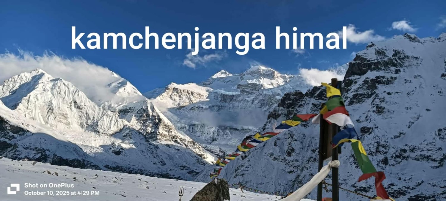
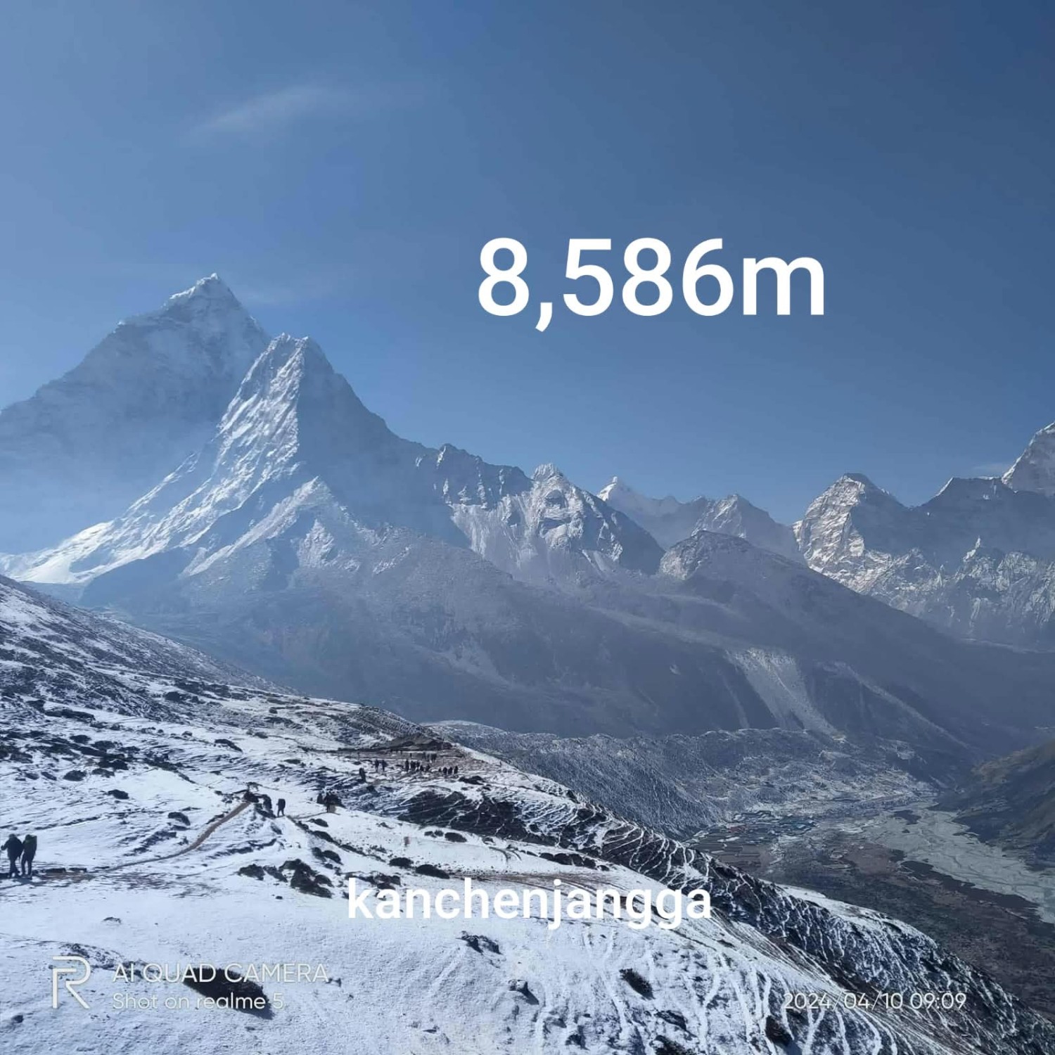
Kangchenjunga is the third-highest peak in the world and the second-highest in Nepal. It is located in the eastern Himalayas on the border between India and Nepal. The mountain rises to an elevation of 8,586 meters (28,169 feet) above sea level and is part of the Great Himalayan Range. The name “Kanchenjunga” is delivered from the Tibetan word 'Kanchen' and ‘Dzonga’ translated means "The Five Treasures of the Great Snows", as it contains five peaks, Kanchenjunga I (8586m), Kanchenjunga West (8505m), Kanchenjunga South (8494m) and Kangbachen (7903m).  The treasures represent the five repositories of God, which are gold, silver, gems, grain, and holy books.

Kangchenjunga has a long and interesting history of climbing. The mountain was first surveyed by the British in 1849, but it wasn't until 1955 that it was finally climbed for the first time. A team of British climbers, led by Joe Brown and George Band, made the first successful ascent of the mountain on May 25, 1955.

Kangchenjunga is considered a challenging and technical mountain to climb, and many people are drawn to it for the sense of accomplishment and personal growth that comes with successfully summiting a mountain of this stature. Some people also climb Kangchenjunga as a way to experience the beauty and majesty of the Himalayas and to spend time in the wilderness.

The Seven Summit Treks, Kangchenjunga Expedition will begin in the second week of April starting in Kathmandu. You will have a couple of days for the preparation of goods and equipment and paper works. Afterward, you will take a flight to Bhadrapur and drive to Phidim. From here your treks begin to Kangchenjunga basecamp. This trip suits those who have previous experiences with a few 7000m peaks or even more. We will do a frequent rotation to each camp for the best acclimatization. The advance basecamp is normally set at (5,475m/17,963ft), Camp I at (6,200m/20,241ft), Camp II at (6,400m/20,997ft), Camp III at (7,100m/23,294ft), Camp IV (7,570m/24770ft) and Summit (8,586m/28,169ft).

" We await to serve you our service and share our experience with you "

WHY CLIMB MT. KANGCHENJUNGA WITH SEVEN SUMMIT TREKS?

  • Highly qualified, professional, friendly, and experienced climbing Sherpa guide, Kitchen staff, and Basecamp Manager.
  • Well-equipped with climbing equipment and logistic support for base camp and higher camps.
  • Safety is a top priority for us, and we take every step to minimize risks and ensure the well-being of our clients.
  • We offer a variety of itineraries to suit different abilities and interests, so you can choose the option that best meets your needs.
  • Hi-tech in weather forecast and communication
  • Easy Helicopter charter service when needed (extra charge to be applied)
  • 1 climbing Sherpa Guide to each member
  • Advance Base camp (5,475m/17,963ft)

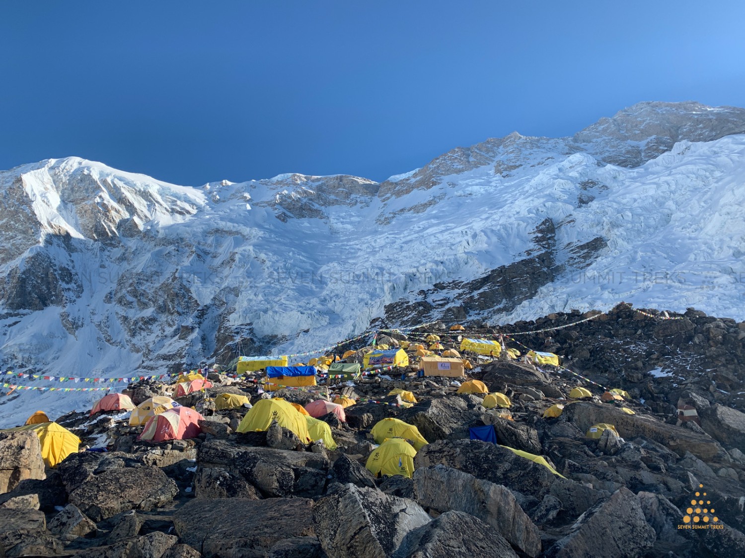
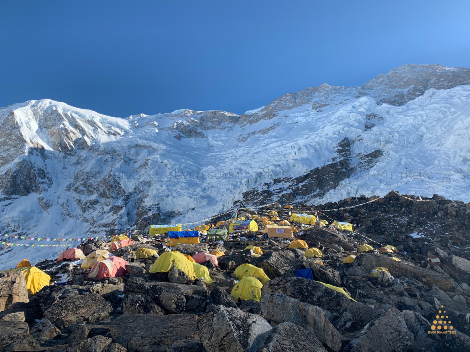
    Either by Heli flight or trek, you will reach Kangchenjunga basecamp of Seven Summit Treks at an altitude of 5,475m. where you will be awaited by our best Sherpa team. Seven Summit has the best basecamp setup. Kangchenjunga basecamp lies on a rocky moraine with amazing views of the massive Mt. Kangchenjunga. You will be spending about a month at base camp. Each member will get a separate member tent and dining, kitchen, shower, communication, and toilet tents. Before we climb the mountain, the base camp will be well settled with the best facility. We make big puja ceromancy at basecamp for good luck and safe climbing.

    Camp I (6,200m/20,241ft)

    For the best acclimatization, once the rope is fixed by the Sherpa team you will climb to camp I which lies at an altitude of 6200m. The mountaineering preparation is direct to the Yalung glacier. In this section of climbing, you will encounter mixed terrain with few crevasses and ice on the section of the glacier. This will take you about 4 to 5 hours of climbing. We will have frequent rotations on camp I and back to base camp.

    Camp II (6,400m/20,997)

    The climbing from camp I to Camp II is the shortest distance. It is a semi-technical section of the Yalung glacier's south face. Camp II's altitude is 6,400m just 200m more than camp I. You need to walk on snow for over an hour and some several steep sections. This will take about 2/3 hours to walk.

    Camp III (7,100m/23,294ft)

    Climbing from camp II to camp III is a long-distance climb at 7000m altitude. It will take about 5 hours to climb from camp to camp III. It's very long and technical climbing on few crevasses are exist, the view from camp III is outstanding although there will be direct sun hitting and this will make hot. Some of the solo climbers or alpine-style climbers target the summit from this part but SST always fixes camp IV for more acclimatization. SST assures that you will have a very comfortable climb with our highly experienced climbing guides/Sherpa.

    Camp IV (7,570m/24,770ft)

    It’s a tough day to climb from camp III to IV because the real climbing beings from this point. You are already at the altitude of 7570m so the oxygen level will be low and some members can feel difficulties. In this section of climbing, you will need to climb for about 3 to 4 hours on steep snow parts. You might have sleep experience if the weather favors you in advance on acclimatization days.

    Summit (8,586m/28,169ft)

    The most important day is summit day. It is the main goal for all climbers. It's a day that climbers dream about. So, most of the climbers begin their summit push at late night and will walk to the summit for about 9/10 hours and will reach the summit about 8-10 am (morning). The Summit of Mt. Kangchenjunga is stunning. You will be mesmerized by the beautiful view of different 8000m peaks. On the same day after taking some pictures, you will walk down to camp III or camp II, which will take about 5 to 6 hours. descending from the summit is also a difficult part of this expedition so safety descent is also an important part of summit day. Seven Summit Treks will have one climbing Sherpa with one member from camp IV to summit day and till back to basecamp. The SST guide will carry an oxygen cylinder for members and himself. For the safe summit of Mt. Kangchenjunga SST will always have a guideline for the best weather forecast, communication, and back support from the basecamp leader. Rope fixing up to the summit is the major duty of our climbing Sherpa so we highly admire our Sherpa for fixing ropes, and making all the effort to get the group reaches to the summit of Mt. Kangchenjunga.

MT. KANGCHENJUNGA EXPEDITION (8586M)
Trekking & Hiking Adventure

Region Kanchenjunga and Makalu Region
Day 1 — Arrival in Kathmandu & Transfer to Hotel
Ups ↑ +00 m
Down ↓ -100 m
Elevation 1400 m
Distance ⟺ 8km

Altitude: 1,350 m · Distance: Approximately 5–8 km airport transfer · Time: 30–60 minutes · Ascent/Descent: Negligible · Overnight: Hotel

Your Kanchenjunga Expedition begins with your arrival at Tribhuvan International Airport in Kathmandu. A representative from Nepal Voyage Treks welcomes you and transfers you to your hotel in the Kathmandu Valley. Depending on traffic and the hotel location, the drive normally takes around 30–60 minutes. After check-in, you can rest, recover from your international flight, and enjoy the first views of Nepal’s capital. No trekking or mountain ascent is planned on this day.

Kathmandu sits in a broad valley surrounded by green hills, with a warm-to-mild climate in spring. You may notice trees, flowering plants, and common urban birds, but this is primarily a rest and arrival day, not a wildlife or mountain-viewing excursion.

Accomodation: hotel
Meals: B/L/D
Duration: 30m
Day 2 — Rest in Kathmandu: Expedition Briefing & Preparation
Ups ↑ 00 m
Elevation 1400 m
Distance ⟺ hours

Altitude: 1,350 m · Distance: Local hotel/office transfers as required · Time: Half to full day · Ascent/Descent: Negligible · Overnight: Hotel · Meals: Breakfast/Dinner

Today is dedicated to expedition preparation and acclimatization in Kathmandu. Your expedition leader reviews the climbing itinerary, safety procedures, equipment, permits, medical and insurance requirements, communications, and the plan for the mountain rotations. This is also the time to check personal climbing gear, pack expedition duffel bags, and complete any final shopping or equipment adjustments.

If time allows, you may enjoy a short cultural walk or sightseeing around Kathmandu. The surrounding hills can offer distant mountain views in clear weather, but the principal purpose of the day is preparation rather than sightseeing. The city’s gardens and wooded areas contain common birds and subtropical vegetation.

Accomodation: hotel
Meals: B/L/D
Duration: 2-3h
Day 3 — Fly from Kathmandu to Bhadrapur & Drive to Phidim
Ups ↑ 100 m
Elevation 1200 m
Distance ⟺ 100km

Altitude: Phidim approximately 1,050–1,200 m · Flight: Approximately 45–55 minutes · Drive: Approximately 80–100 km · Drive Time: 3–5 hours · Ascent/Descent: Variable road ascent and descent · Overnight: Lodge · Meals: Breakfast, Lunch & Dinner

After breakfast, you fly from Kathmandu to Bhadrapur Airport, the gateway to eastern Nepal. From Bhadrapur, the journey continues by private vehicle toward Phidim, the main town of Panchthar District. The road passes through the eastern foothills, with changing landscapes of farmland, forests, rivers, and hillside settlements.

This is a scenic transition from the busy capital to the quieter eastern hills. Depending on the exact route and road conditions, the journey may take several hours. Along the way, you may see cultivated terraces, cardamom-growing areas, subtropical vegetation, and common birds. The distant high Himalaya is generally not the main view on this day.

Overnight: Lodge in Phidim.

Accomodation: lodge
Meals: B/L/D
Duration: drive 5h
Day 4 — Drive from Phidim to Yamphudin
Ups ↑ 1100 m
Down ↓ 200 m
Elevation 2080 m
Distance ⟺ 100km

Altitude: Yamphudin approximately 2,080 m · Distance: Approximately 80–100 km by road · Drive Time: 5–8 hours · Ascent: Approximately 900–1,100 m · Descent: Variable · Overnight: Lodge · Meals: Breakfast, Lunch & Dinner

Today you leave Phidim and continue by road toward Yamphudin, one of the important settlements on the southern Kanchenjunga approach. The drive becomes increasingly remote as you travel through winding hill roads, river valleys, and forested slopes. Road conditions may be rough in places, and the actual travel time depends on weather, road repairs, and traffic.

Yamphudin is a culturally rich mountain village inhabited by communities including Limbu and Sherpa people. It is an important staging point before the high-altitude trekking section. From the village, you can enjoy views of surrounding green hills and valleys, while the higher snow-covered peaks may appear in clear weather.

The vegetation gradually changes from subtropical and temperate forest to cooler mountain forest. You may see rhododendron, bamboo, oak, and other woodland species, along with common birds and small mammals.

Overnight: Lodge in Yamphudin.

Accomodation: lodge
Meals: B/L/D
Duration: 5-8h
Day 5 — Acclimatization in Yamphudin
Ups ↑ 500 m
Down ↓ 300 m
Elevation 2080 m
Distance ⟺ 6km

Altitude: 2,080 m · Distance: Optional 3–6 km acclimatization walk · Time: 2–4 hours optional hiking · Ascent/Descent: Gentle, depending on the walk · Overnight: Lodge · Meals: Breakfast, Lunch & Dinner

Today is a rest and acclimatization day in Yamphudin. You can explore the village, walk around nearby trails, visit local homes, and enjoy the surrounding scenery. The day is designed to help your body adjust to the increasing altitude before entering the remote mountain valleys.

A short hike through the surrounding hills provides views of cultivated terraces, forested slopes, and the Simbua Khola valley. In spring, rhododendrons may be flowering, and the forests are often alive with birds. You may also see local livestock, including cattle, goats, and pack animals used for transport.

This is a good day to learn about the local culture, meet villagers, and prepare for the first long trekking day.

Accomodation: lodge
Meals: dinner
Duration: 4h
Day 6 — Trek from Yamphudin to Tortong
Ups ↑ 900 m
Down ↓ 450 m
Elevation 2995 m
Distance ⟺ 10km


Altitude: Yamphudin 2,080 m → Tortong 2,995 m · Distance: Approximately 9–10 km · Walking Time: 6–7 hours · Ascent: Approximately 900–1,000 m · Descent: Approximately 400–450 m · Overnight: Lodge · Meals: Breakfast, Lunch & Dinner

The trek begins with a steady climb from Yamphudin through forested hills and along the Simbua Khola valley. The trail passes through bamboo and rhododendron forests, crosses streams, and follows the rugged mountain landscape toward Tortong. You may pass through small clearings and forest campsites before reaching the settlement.

The route is known for its rich woodland scenery. In spring, the rhododendrons can be especially beautiful, with red, pink, and white flowers contrasting against the green forest. The trail also offers opportunities to see mountain birds and other forest wildlife, although sightings are not guaranteed.

As you approach Tortong, the environment becomes cooler and more alpine. The village is a small mountain settlement surrounded by forest and steep slopes.

Overnight: Lodge in Tortong.

Accomodation: lodge
Meals: B/L/D
Duration: 7h
Day 7 — Trek from Tortong to Tseram
Ups ↑ 875 m
Elevation 3870 m
Distance ⟺ 10km

Altitude: Tortong 2,995 m → Tseram 3,870 m · Distance: Approximately 10 km · Walking Time: 5–6 hours · Ascent: Approximately 875 m · Descent: Minimal · Overnight: Lodge · Meals: Breakfast, Lunch & Dinner

Today’s trek follows the Simbua Khola upstream toward Tseram, also known as Cheram. The valley gradually widens as you climb higher, and the forest becomes more open. The trail passes through rhododendron, fir, and coniferous woodland, with occasional views of the surrounding high mountain ridges.

As you approach Tseram, the landscape begins to change from dense forest to alpine vegetation. The village is an important acclimatization point for trekkers and climbers heading toward the southern Kanchenjunga base-camp region.

On clear days, you may begin to see dramatic mountain peaks, including Kabru, Rathong, and the Kanchenjunga massif. These mountains become more prominent as you gain altitude.

Overnight: Lodge in Tseram.

Accomodation: lodge
Meals: B/L/D
Duration: 6h
Day 8 — Acclimatization in Tseram: Hike to Ramche
Ups ↑ 700 m
Down ↓ 700 m
Elevation 4580 m
Distance ⟺ 12km

Altitude: Tseram 3,870 m → Ramche approximately 4,580 m · Distance: Approximately 10–12 km round trip · Walking Time: 5–7 hours · Ascent: Approximately 700 m · Descent: Approximately 700 m · Overnight: Lodge · Meals: Breakfast, Lunch & Dinner

Today is an important acclimatization day. You hike from Tseram toward Ramche, following the Yalung Valley into the high-altitude landscape. The trail gradually leaves the forest behind and enters alpine meadows, rocky slopes, and glacial terrain.

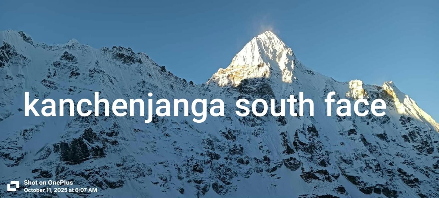
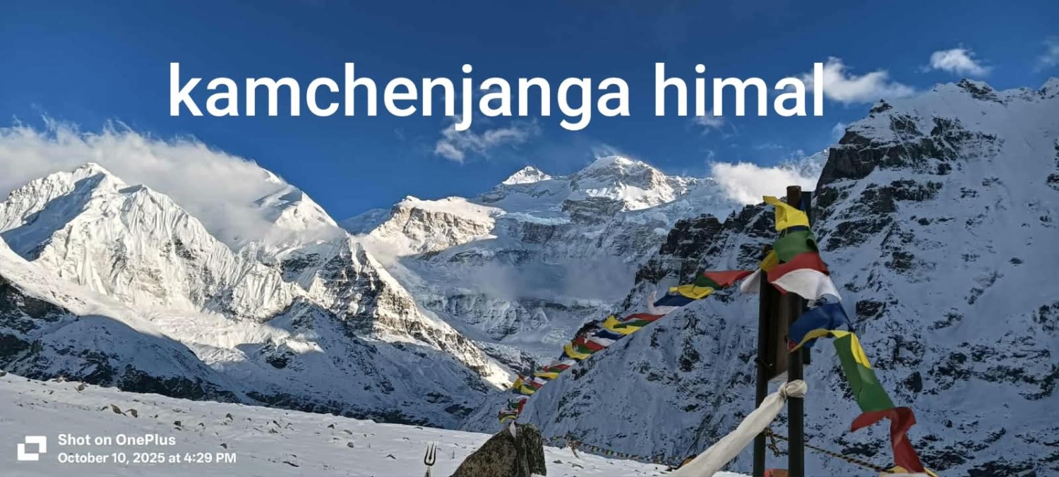
The hike provides spectacular views of the Kanchenjunga South Face, Kabru, Rathong, and surrounding peaks. You may also see the Yalung Glacier and high mountain ridges. This is one of the most scenic days of the expedition.

The landscape supports alpine grasses, dwarf shrubs, and hardy flowering plants. Wildlife is less common at this altitude, but you may see birds, Himalayan marmots, or signs of blue sheep and other mountain animals.

After spending time at Ramche, you return to Tseram for the night to sleep at a lower altitude.

Overnight: Lodge in Tseram.

Accomodation: lodge
Meals: B/L/D
Duration: 7h
Day 9 — Acclimatization in Tseram
Ups ↑ lodge m
Elevation 3870 m
Distance ⟺ hours

Altitude: 3,870 m · Distance: Optional 2–5 km local walk · Time: 2–4 hours optional hiking · Ascent/Descent: Gentle · Overnight: Lodge · Meals: Breakfast, Lunch & Dinner

This is another rest and acclimatization day in Tseram. The main purpose is to allow your body to adapt to the altitude before the helicopter flight and the higher expedition camps.

You may take a short walk around the village or rest at the lodge. The surrounding landscape includes alpine meadows, rocky slopes, and views of the southern Kanchenjunga massif. Spring weather may bring clear mornings and occasional afternoon clouds.

The flora is mainly alpine grasses, dwarf shrubs, and hardy mountain plants. Wildlife sightings are possible but uncommon at this elevation. This is an ideal day to prepare for the helicopter flight and the high-altitude environment of base camp.

Accomodation: lodge
Meals: B/L/D
Duration: 4h
Day 10 — Fly by Helicopter from Tseram to Kanchenjunga Base Camp
Ups ↑ 1605 m
Elevation 5475 m
Distance ⟺ 40 m fly

Altitude: Tseram 3,870 m → Proposed Base Camp 5,475 m · Flight Time: Approximately 20–40 minutes, weather permitting · Ascent: Approximately 1,605 m · Descent: None on this day · Overnight: Tent · Meals: Breakfast, Lunch & Dinner

Today you fly by helicopter from Tseram to the proposed Kanchenjunga Base Camp at 5,475 m. This is a major transition from the trekking phase to the expedition phase. The helicopter flight offers breathtaking aerial views of the high Himalaya, glaciers, and remote valleys.

Important: The 5,475 m elevation is the base-camp altitude in your supplied itinerary. It should be confirmed with the expedition operator because the standard Kanchenjunga North Base Camp approach is associated with Pangpema, while the southern route reaches Oktang at a lower elevation.


Places Nepal Treks+1

At base camp, you settle into your tent, meet the expedition team, and begin the final preparation for the climbing period. The environment is harsh and high-altitude, with rocky ground, snow, glaciers, and very limited vegetation.

Overnight: Expedition tent at Base Camp.

Accomodation: lodge
Meals: B/L/D
Duration: 40m
Day 11 — 11–35 – Expedition Rotation: Base Camp, Camp I, Camp II, Camp III & Return


Altitude: Approximately 5,475 m to higher camps · Distance: Variable according to route · Time: Variable, depending on climbing conditions · Ascent/Descent: Variable · Overnight: Expedition tents · Meals: Full Board

This is the expedition rotation period, during which climbers move between Base Camp and higher camps to acclimatize, establish camps, carry equipment, and prepare for the summit attempt. The exact number of rotations, camp elevations, and climbing distances depend on the chosen route, weather, snow conditions, and the expedition leader’s plan.

A typical rotation may involve climbing from Base Camp toward Camp I, continuing to Camp II or Camp III, and then descending back to Base Camp for rest and recovery. The team may carry ropes, oxygen, food, fuel, and climbing equipment to higher camps. Rest days at Base Camp are essential for acclimatization and physical recovery.

The mountain landscape is dominated by glaciers, snow slopes, rocky ridges, and high-altitude terrain. Vegetation is extremely sparse, and wildlife sightings are rare. You may see birds such as snow pigeons or choughs in lower alpine areas, but the higher camps are primarily a world of snow and ice.

Overnight: Expedition tents at Base Camp or higher camps.

Accomodation: camp tent
Meals: B/L/D
Day 12 — 36–45 – Climbing Period: Base Camp to Kanchenjunga Summit & Return

Altitude: Base Camp approximately 5,475 m → Summit 8,586 m · Distance: Variable, depending on route and camp locations · Time: Variable, with summit day often 12–18+ hours · Ascent/Descent: Major ascent and descent · Overnight: Expedition tents · Meals: Full Board

This is the summit climbing period. The team begins the final push from Base Camp toward the higher camps and ultimately the summit of Mount Kanchenjunga at 8,586 m, the third-highest mountain in the world.

The summit attempt is highly dependent on weather, snow conditions, route safety, and the expedition leader’s decision. Climbers may spend several days moving between camps, resting, and waiting for a suitable weather window. The summit day is usually the most demanding day of the expedition, requiring long hours of climbing in extreme cold and high altitude.

From the upper camps, the views include the massive Kanchenjunga massif, surrounding peaks, glaciers, and high Himalayan ridges. The terrain is almost entirely snow, ice, and rock, with virtually no vegetation. Wildlife is not expected at the summit or upper camps.

After the summit attempt, the team descends back toward Base Camp, where you can rest, recover, and prepare for the return journey.

Overnight: Expedition tents.

Altitude: Base Camp approximately 5,475 m → Summit 8,586 m · Distance: Variable, depending on route and camp locations · Time: Variable, with summit day often 12–18+ hours · Ascent/Descent: Major ascent and descent · Overnight: Expedition tents · Meals: Full Board

This is the summit climbing period. The team begins the final push from Base Camp toward the higher camps and ultimately the summit of Mount Kanchenjunga at 8,586 m, the third-highest mountain in the world.

The summit attempt is highly dependent on weather, snow conditions, route safety, and the expedition leader’s decision. Climbers may spend several days moving between camps, resting, and waiting for a suitable weather window. The summit day is usually the most demanding day of the expedition, requiring long hours of climbing in extreme cold and high altitude.

From the upper camps, the views include the massive Kanchenjunga massif, surrounding peaks, glaciers, and high Himalayan ridges. The terrain is almost entirely snow, ice, and rock, with virtually no vegetation. Wildlife is not expected at the summit or upper camps.

After the summit attempt, the team descends back toward Base Camp, where you can rest, recover, and prepare for the return journey.

Overnight: Expedition tents.

Accomodation: camp tent
Meals: B/L/D
Day 13 — 46 – Fly by Helicopter from Base Camp to Tapetok
Ups ↑ none m
Elevation 1300 m

Altitude: Base Camp approximately 5,475 m → Tapetok approximately 1,300–1,500 m · Flight Time: Approximately 30–60 minutes, weather permitting · Ascent: None · Descent: Approximately 4,000 m or more · Overnight: Lodge · Meals: Breakfast, Lunch & Dinner

After completing the expedition, you fly by helicopter from Base Camp to Tapetok, a lower settlement near the road-accessible southern Kanchenjunga region. This is a dramatic change in altitude and environment, from the icy high mountains to the greener river valleys.

The flight may provide aerial views of glaciers, mountain ridges, forests, and remote villages. Once in Tapetok, you can rest at the lodge and enjoy the warmer climate. The surrounding area contains subtropical and temperate vegetation, with forests, farmland, and river valleys.

Overnight: Lodge in Tapetok.

Accomodation: lodge
Meals: B/L/D
Duration: 30 minuts
Day 14 — Drive from Tapetok to Bhadrapur via Phidim
Ups ↑ 200 m
Down ↓ 100 m
Elevation 1500 m
Distance ⟺ 200km

Altitude: Tapetok approximately 1,300–1,500 m → Bhadrapur approximately 91 m · Distance: Approximately 150–200 km by road · Drive Time: 7–10 hours · Ascent/Descent: Long descent toward the lowlands · Overnight: Hotel · Meals: Breakfast, Lunch & Dinner

Today you begin the long drive from Tapetok toward Bhadrapur, passing through Phidim and the eastern hill roads. The journey follows winding roads through mountain valleys, forested slopes, and cultivated terraces.

The landscape changes significantly as you descend: cooler mountain forests gradually give way to warmer subtropical vegetation and lower-elevation farmland. You may see cardamom plantations, bamboo, broadleaf forests, and villages along the route.

This is a scenic but long travel day, allowing you to enjoy the eastern hills and reflect on the expedition.

Overnight: Hotel in Bhadrapur.

Accomodation: hotel lodge
Meals: B/L/D
Duration: drve 10h

ASSOCIATED WITH

Tourism Board
Nepal Government
Keep
NMA Nepal
TAAN

WE ACCEPT